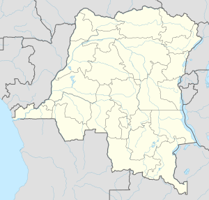
Mont Mohi is a mountain in the Democratic Republic of Congo.[2] It is located in the province of South Kivu Province, in the eastern part of the country, 1,500 km east of Kinshasa the capital of the country. 3,480 meters above sea level.[2]
| Mount Mohi | |
|---|---|
 | |
| Highest point | |
| Elevation | 3,480 m (11,420 ft)[1] |
| Prominence | 1,592 m (5,223 ft) |
| Listing | Ultra Ribu |
| Geography | |
| Location | Democratic Republic of the Congo |
The land around Mont Mohi is hilly in the southeast, but in the northwest it is a mountain. Panoramas, within a 10 kilometer radius.[3] Mont Mohi is the highest point in the area. There are about 266 people per square kilometer around Mont Mohi which is highly populated.[4] The area around Mont Mohi is almost covered by durowan and bugangan.[5]
Climate
editThe average temperature is 10 °C. The warmest month is December, at 10 °C, and the coldest is November, at 8 °C.[6] The average rainfall is 923 millimeters per year. The wettest month is December, with 163 millimeters of rain, and the driest is July, with 14 millimeters.[7]
| ||||||||||||||||||||||||||||||||||||||||||||||||||||||||||||||||||||||||||||||||||||||||||||||||||||||||||||||||||||||||||||
References
edit- ^ "World Ribus – East Africa Mountains". World Ribus. Retrieved 26 December 2024.
- ^ a b Mont Mohi and GeoNames.Org (cc-by); post updated 2009-04-07; database download on 2015-12-29
- ^ "Viewfinder Panoramas Digital elevation Model". 21 June 2015.
- ^ "NASA Earth Observations: Population Density". NASA/SEDAC. Retrieved 30 January 2016.
- ^ "NASA Earth Observations: Land Cover Classification". NASA/MODIS. Retrieved 30 January 2016.
- ^ a b "NASA Earth Observations Data Set Index". NASA. Retrieved 30 January 2016.
- ^ "NASA Earth Observations: Rainfall (1 month - TRMM)". NASA/Tropical Rainfall Monitoring Mission. Retrieved 30 January 2016.
2°57′12″S 28°47′17″E / 2.95333°S 28.78806°E
This article needs additional or more specific categories. (April 2024) |
