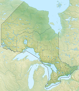
McKenzie Lake (French: lac McKenzie) is a lake in South Algonquin, Nipissing District and Hastings Highlands, Hastings County in Ontario, Canada.[1][2][4][5][6] It is in the Saint Lawrence River drainage basin, is part of the Madawaska River river system, and lies about 14 kilometres (9 mi) south of the community of Madawaska and a similar distance north of the small town of Maynooth. The settlement of McKenzie Lake is on the north shore of the lake.[2][5]
| McKenzie Lake | |
|---|---|
| lac McKenzie | |
| Location | Nipissing District and Hastings County, Ontario |
| Coordinates | 45°21′51″N 78°01′22″W / 45.36417°N 78.02278°W[1] |
| Part of | Saint Lawrence River drainage basin |
| Primary inflows | Moore Creek |
| Primary outflows | Moore Creek |
| Basin countries | Canada |
| Max. length | 3.5 km (2.2 mi)[2] |
| Max. width | 1.1 m (3 ft 7 in)[2] |
| Surface elevation | 395 m (1,296 ft)[3] |
| Settlements | McKenzie Lake |
The primary inflow is Moore Creek at the east, arriving from the direction of Cross Lake, with another unnamed inflow at the northwest; there are several other secondary unnamed inflows, including one at the south arriving from North Chainy Lake and another arriving at the northeast from Turf Lake. The primary outflow, at the northern tip of the lake, is also Moore Creek, which heads north towards Moore Lake, and then flows via the Madawaska River and the Ottawa River to the Saint Lawrence River.[1][2][4][5]
McKenzie Lake is about 3.5 kilometres (2.2 mi) long and 1.1 kilometres (0.7 mi) wide and lies at an elevation of 395 metres (1,296 ft). It is roughly L-shaped, with the long axis running south-southwest to north-northeast, and the smaller extension running to about 1.5 kilometres (0.93 mi) to the south off the western end. The lake is almost entirely in South Algonquin, Nipissing District, except for the southwestern tip, which is in Hastings Highlands, Hastings County, and thus straddles the traditional boundary between northern and southern Ontario, more specifically Nipissing District in Northeastern Ontario and Hastings County in Central Ontario.[5]
The shore of the southwestern tip of the lake is part of Lake St. Peter Provincial Park, but none of the lake itself.[5]
See also
editReferences
edit- ^ a b c "McKenzie Lake". Geographical Names Data Base. Natural Resources Canada. Retrieved 2020-04-15.
- ^ a b c d e "Toporama (on-line map and search)". Atlas of Canada. Natural Resources Canada. Retrieved 2020-04-15.
- ^ "Google Earth". Retrieved 2020-04-15.
- ^ a b Restructured municipalities - Ontario map #5 (Map). Restructuring Maps of Ontario. Ontario Ministry of Municipal Affairs and Housing. 2006. Retrieved 2020-04-15.
- ^ a b c d e "Ontario Geonames GIS (on-line map and search)". Ontario Ministry of Natural Resources and Forestry. 2014. Retrieved 2020-04-15.
- ^ Map 10 (PDF) (Map). 1 : 700,000. Official road map of Ontario. Ministry of Transportation of Ontario. 2018-01-01. Retrieved 2020-04-15.
