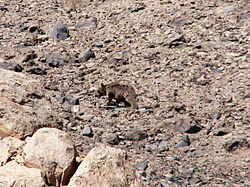
Lar National Park (Persian پارک ملی لار park-e melli-e lar) is a protected area in Amol County of Mazandaran Province in northern Iran.

Geography
editThe 30,000-hectare (74,000-acre) park is in the Central Alborz mountain range, at the foot of Mount Damavand.[1]
It has been a national park since 1976 and a protected area since 1982 by the Iran Department of Environment. Since 1991 hunting has been prohibited.[2][3] The Lar Dam and reservoir is located within the park. The park is accessible via Haraz road (Road 77).
Flora and fauna
editOne of the rare species of the fish family Salmonidae is native to this area.
Central Alborz mountain range map
edit| Map of central Alborz | Peaks: | 1 Alam-Kuh |
|---|---|---|
−25 to 500 m (−82 to 1,640 ft) 500 to 1,500 m (1,600 to 4,900 ft) 1,500 to 2,500 m (4,900 to 8,200 ft) 2,500 to 3,500 m (8,200 to 11,500 ft) 3,500 to 4,500 m (11,500 to 14,800 ft) 4,500 to 5,610 m (14,760 to 18,410 ft) |
2 Azad Kuh | 3 Damavand |
| 4 Do Berar | 5 Do Khaharan | |
| 6 Ghal'eh Gardan | 7 Gorg | |
| 8 Kholeno | 9 Mehr Chal | |
| 10 Mishineh Marg | 11 Naz | |
| 12 Shah Alborz | 13 Sialan | |
| 14 Tochal | 15 Varavašt | |
| Rivers: | 0 | |
| 1 Alamut | 2 Chalus | |
| 3 Do Hezar | 4 Haraz | |
| 5 Jajrood | 6 Karaj | |
| 7 Kojoor | 8 Lar | |
| 9 Noor | 10 Sardab | |
| 11 Seh Hazar | 12 Shahrood | |
| Cities: | 1 Amol | |
| 2 Chalus | 3 Karaj | |
| Other: | D Dizin | |
| E Emamzadeh Hashem | K Kandovan Tunnel | |
| * Latyan Dam | ** Lar Dam |
References
edit- ^ "Lar National Park". ProtectedPlanet. Retrieved 2012-05-20.
- ^ "پارک ملی لار - Irandeserts database". Irandeserts.com. Retrieved 2012-05-20.
- ^ "آشنایی با پارک ملی لار - Hamshahri newspaper". Hamshahrionline.ir. Retrieved 2012-05-20.
External links
editWikimedia Commons has media related to Lar National Park.