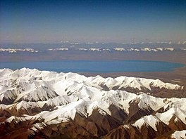
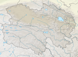
Lake Hala (also: Hala Hu, Har Hu), is a closed lake located at 4078m above sea level in the Qilian mountains, at the northeastern margin of the Tibetan Plateau, Qinghai Province, China.
| Lake Hala | |
|---|---|
 Lake Hala in the Qilian Shan | |
| Location | |
| Coordinates | 38°18′N 97°36′E / 38.300°N 97.600°E |
| Primary outflows | no |
| Surface area | 596 km2 (230 sq mi) |
| Max. depth | 65 m (213 ft) |
| Surface elevation | 4,078 m (13,379 ft) |
Its surface area is 596 km2. It is a brackish lake with a salinity of ca 1.8% (18 psu). The shore zone is relatively shallow, while the maximum depth at the center of the lake is 65 m. The lake catchment is a basin of 4690 km2 without an outflow. The highest surrounding mountains (Shule Nanshan north of the lake), exceed 5800 m above sea level.[1]
Due to the influence of the surrounding glaciers, the water level of the lake and its ecosystem reacts sensitively to meltwater pulses.[2][3]
References
edit- ^ Wünnemann, Bernd; Wagner, Johannes; Zhang, Yongzhan; Yan, Dada; Wang, Rong; Shen, Yan; Fang, Xiaoyu; Zhang, Jiawu (2012). "Implications of diverse sedimentation patterns in Hala Lake, Qinghai Province, China for reconstructing Late Quaternary climate". Journal of Paleolimnology. 48 (4): 725–749. doi:10.1007/s10933-012-9641-2. S2CID 129834112.
- ^ Yan, Dada; Wünnemann, Bernd (2014). "Late Quaternary water depth changes in Hala Lake, northeastern Tibetan Plateau, derived from ostracod assemblages and sediment properties in multiple sediment records". Quaternary Science Reviews. 95: 95–114. doi:10.1016/j.quascirev.2014.04.030.
- ^ Aichner, Bernhard; Wünnemann, Bernd; Callegaro, Alice; van der Meer, Marcel T. J.; Yan, Dada; Zhang, Yongzhan; Barbante, Carlo; Sachse, Dirk (2022). "Asynchronous responses of aquatic ecosystems to hydroclimatic forcing on the Tibetan Plateau". Communications Earth & Environment. 3 (1): 3. doi:10.1038/s43247-021-00325-1. S2CID 245830274.
