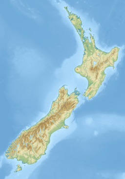
Lake Alabaster / Wāwāhi Waka, also known by the Māori name of Waiwahuika, lies at the northern end of Fiordland, in the southwest of New Zealand's South Island.[1] The lake runs from northeast to southwest, is five kilometres (3.1 mi), and covers seven km2 (2.7 sq mi).[2]
| Lake Alabaster / Wāwāhi Waka | |
|---|---|
 Lake Alabaster at the Hollyford Track, New Zealand. | |
 | |
| Location | South Island |
| Coordinates | 44°31′S 168°10′E / 44.517°S 168.167°E |
| Primary inflows | Pyke River |
| Primary outflows | Pyke River |
| Basin countries | New Zealand |
| Max. length | 6 km (3.7 mi) |
| Surface area | 7 km2 (2.7 sq mi) |
Lake Alabaster drains, and is drained by, the Pyke River, a small tributary of the Hollyford River / Whakatipu Kā Tuka.[3] It is one of two lakes (along with Lake McKerrow / Whakatipu Waitai) found in the lower reaches of the Hollyford River system.[4] A branch of the Hollyford Track, one of New Zealand's most well-known and popular tramping tracks, extends along the eastern shore of the lake.[1]
The lake was formed at the southern end of a glacial valley and, had the sea level been slightly higher, would have been the northern arm of what might have been McKerrow Fiord.[citation needed]
References
edit- ^ a b "Everything you need to know about the Hollyford Track". www.adventuresouth.co.nz. 2021. Retrieved 19 January 2021.
- ^ J Irwin (1975). "Checklist of New Zealand lakes" (PDF). New Zealand Oceanographic Institute Memoir. 74: 1–161. ISSN 0083-7903. Wikidata Q66412037.
- ^ Grzelewski, Derek (2014). Going to extremes : adventures in unknown New Zealand. Auckland, New Zealand: David Bateman Ltd. p. 76. ISBN 978-1-86953-826-2. OCLC 881768862.
- ^ The story of Fiordland National Park : mountains of water. Wellington, N.Z.: Department of Lands & Survey. 1986. p. 144. ISBN 0-477-06140-0. OCLC 43039606.
