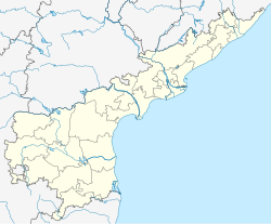
Kurukuru is a village located in Devarapalle, West Godavari district in the state of Andhra Pradesh, India. Nidadavole and Rajamundry railway station are the nearest railway stations.
Kurukuru | |
|---|---|
 Dynamic map | |
| Coordinates: 16°59′N 81°32′E / 16.98°N 81.54°E | |
| country | |
| State | Andhra Pradesh |
| District | West Godavari |
| Mandal | Devarapalle |
| Talukas | Devarapalle, West Godavari district |
| Government | |
| • Type | Panchayat |
| Population (2011) | |
• Total | 1,590 |
| Languages | |
| • Official | Telugu |
| Time zone | UTC+5:30 (IST) |
| PIN | 534305 |
| Area code | 08813 |
| ISO 3166 code | IN-WB |
| Vehicle registration | [AP37] |
| Nearest city | Eluru |
| Lok Sabha constituency | Rajahmundry |
| Vidhan Sabha constituency | Gopalapuram |
| Climate | hot (Köppen) |
Etymology
editIn ancient times this village was named as "Kotthuru" (Kotthavuru people pronounce as kotthuru), later on renamed as Kurukuru.
Urbanisation
editWhen coming to
Demographics
editAs of 2011[update] Census of India, Kurukuru had a population of 1590. The total population constitutes 794 males and 797 females with a sex ratio of 1003 females per 1000 males. 162 children are in the age group of 0–6 years, with sex ratio of 862. The average literacy rate stands at 69.33%.[1]
Temples
editFew things about the village there are 7 temples most people are devotional
References
edit- ^ "Kurukuru Population Census". Retrieved 19 May 2017.

