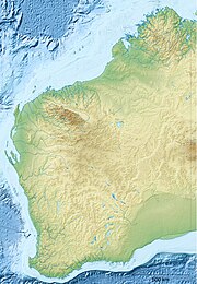
Kennedy Range National Park is a national park in Gascoyne region of Western Australia, approximately 830 kilometres (520 mi)[2] north of Perth and about 150 km (93 mi)[3] east of Carnarvon.
| Kennedy Range National Park Western Australia | |
|---|---|
 Kennedy Range from Escarpment Trail | |
 | |
| Nearest town or city | Carnarvon |
| Coordinates | 24°34′45″S 115°02′59″E / 24.57917°S 115.04972°E |
| Established | 1993 |
| Area | 1,416.6 km2 (547.0 sq mi)[1] |
| Managing authorities | Department of Environment and Conservation |
| Website | Kennedy Range National Park |
| See also | List of protected areas of Western Australia |
Kennedy Range is found on the edge of the Gascoyne River catchment area and is a weathered plateau that extends for a distance of 150 km (93 mi),[4] essentially forming a huge mesa. Spectacular sandstone cliffs can be found on the southern and eastern sides of the range, which are dissected by steep canyons which have an elevation of up to 100 metres (330 ft).[5]
The Range formed a natural border for two Aboriginal peoples, the Maia and the Malgaru. Natural springs located on the edge of the ranges would have provided game to hunt and outcrops of chert would have provided stone for tools. Over 100 sites provide evidence that the Indigenous Australians inhabited the area for over 20,000 years prior to European settlement.
The first European to explore the area was Francis Thomas Gregory, whose expedition reached the range in 1858. Gregory named the range after the Governor of Western Australia at the time, Arthur Edward Kennedy. He also named the nearby Lyons River in the same expedition before continuing to Mount Augustus. Pastoralists arrived in the area shortly afterwards with Charles Brockman setting up Boolathana Station in 1877, and the region experienced success in wool production until the 1930s when the overgrazing, drought and the Great Depression caused most businesses to fail.[3]
The valleys and plains of the range had been severely degraded but the range top was only slightly damaged as a result of pastoral activity. The area has been explored for minerals but has not been mined.
The park was officially gazetted in 1993 and contains some facilities for visitors. A bush toilet and camp-sites are located at Temple Gorge, but it is planned[when?] to relocate this camp ground. There are a number of walk trails within the park but no water is available. Entry to the park is free but camp-site fees apply.[3]
A popular time to visit the park is following heavy rains when wildflowers emerge. Over 80 species of wildflower are known to inhabit the park, including mulla mulla,[6] hakeas, eremophilas, Calytrix, verticordias and various everlasting daisies.[7]
A species of lizard Lerista kennedyensis, commonly called the "Kennedy Range broad-blazed slider", is named after the Kennedy Range.[8]
See also
editReferences
edit- ^ "Department of Environment and Conservation 2009–2010 Annual Report". Annual Report. Department of Environment and Conservation: 48. 2010. ISSN 1835-114X. Archived from the original on 11 January 2011.
- ^ "Great Circle Distance between Kennedy Range and Perth". Geoscience Australia. March 2004. Archived from the original on 10 October 2012.
- ^ a b c "Department of the Environment - Park Finder - Kennedy Range National Park". 2010. Retrieved 14 June 2010.
- ^ "Australian National Parks". 2010. Archived from the original on 7 January 2017. Retrieved 14 June 2010.
- ^ "Western Australia Tourism - Kennedy Range National Park". 2010. Archived from the original on 16 July 2011. Retrieved 14 June 2010.
- ^ "Australia's Coral Coast" (PDF). 2010. Retrieved 19 June 2010.[permanent dead link]
- ^ "Ross Graden Tours". 2009. Archived from the original on 14 September 2009. Retrieved 19 June 2010.
- ^ Beolens, Bo; Watkins, Michael; Grayson, Michael (2011). The Eponym Dictionary of Reptiles. Baltimore: Johns Hopkins University Press. xiii + 296 pp. ISBN 978-1-4214-0135-5. (Kennedy, p. 139).
