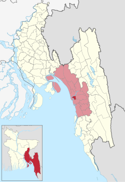
Karnaphuli (Bengali: কর্ণফুলী) is an Upazila of Chattogram District in Chattogram Division, Bangladesh. Administration Karnaphuli Thana was established on 27 May 2000.[2][3] Karnaphuli, a police station area under Chattogram's Patiya, has been upgraded to an Upazila.[4]
Karnaphuli Sub-District
কর্ণফুলী উপজেলা | |
|---|---|
 | |
| Coordinates: 22°18′N 91°54′E / 22.3°N 91.9°E | |
| Country | |
| Division | Chittagong |
| District | Chittagong |
| Area | |
| • Total | 55.36 km2 (21.37 sq mi) |
| Population | |
| • Total | 203,705 |
| • Density | 3,700/km2 (9,500/sq mi) |
| Time zone | UTC+6 (BST) |
| Website | karnafuli |
Demographics
editAs of the 2011 Bangladesh census, Karnaphuli upazila had 29,975 households and a population of 162,110. 24,015 (14.81%) were under 7 years of age. Karnaphuli had an average literacy rate of 52.07%, compared to the national average of 51.8%, and a sex ratio of 936 females per 1000 males. The entire population was rural.[6][7]
Administrative
editMunicipality
edit- Karnaphuli
Union
edit- Char Patharghata
- Shikalbaha
- Char Lakhya
- Juldha
- Bara Uthan
See also
editReferences
edit- ^ National Report (PDF). Population and Housing Census 2022. Vol. 1. Dhaka: Bangladesh Bureau of Statistics. November 2023. p. 396. ISBN 978-9844752016.
- ^ Baten, Md. Abdul (2012). "Karnafuli Thana". In Islam, Sirajul; Jamal, Ahmed A. (eds.). Banglapedia: National Encyclopedia of Bangladesh (Second ed.). Asiatic Society of Bangladesh.
- ^ Mahmud, Tarek (9 June 2012). "Ctg police stations in shabby state". The Daily Star.
- ^ "Karnaphuli becomes Bangladesh's 490th Upazila". bdnews24.com. 9 May 2016.
- ^ Population and Housing Census 2022 - District Report: Chattogram (PDF). District Series. Dhaka: Bangladesh Bureau of Statistics. June 2024. ISBN 978-984-475-247-4.
- ^ "Bangladesh Population and Housing Census 2011 Zila Report – Chittagong" (PDF). bbs.gov.bd. Bangladesh Bureau of Statistics.
- ^ "Community Tables: Chittagong district" (PDF). bbs.gov.bd. Bangladesh Bureau of Statistics. 2011.