Kalem Island (Turkish: Kalem Adası, literally "Pen Island") is an Aegean island of Turkey. Administratively, the island is a part of Dikili ilçe (district) of İzmir Province at 9°0′12″N 26°47′42″E / 9.00333°N 26.79500°E.[1] It is close to Bademli town and its distance to main land (Anatolia) is about 400 metres (1,300 ft). It is a narrow island where the maximum length in the north to south direction is about 1.5 kilometres (0.93 mi)
Native name: Kalem Adası | |
|---|---|
 NASA image showing Kalem Island and nearby Garip Islands | |
 Kalem Island | |
| Geography | |
| Location | Aegean Sea |
| Coordinates | 39°0′12″N 26°47′42″E / 39.00333°N 26.79500°E |
| Administration | |
| İl (province) | İzmir Province |
| İlçe | Dikili |
The island and Garip Island to the west were known as two of the three Arginusae islands (Greek: Ἀργινούσαι Arginóusai) in antiquity (the third island Canae is now a peninsula).
The naval battle of Arginusae was fought around Kalem island in 406 B.C.
The island is a private property. There is a hotel and a beach for tourists and divers.[2]
Gallery
edit-
 Northern tip of Kalem Island with hotel
 -
 Kalem Island southern coast
 -
Coming around the south eastern tip of Kalem Island
-
 Rocks on the southern tip of the coast of Kalem Island, Turkey
 -
 North west coastal tip of Kalem Island with hotel
 -
 North west coast of Kalem Island with hotel
 -
 Hotel on north west coast of Kalem Island
 -
 Rocks northwest of Kalem island
 -
 North eastern coast of Kalem Island
 -
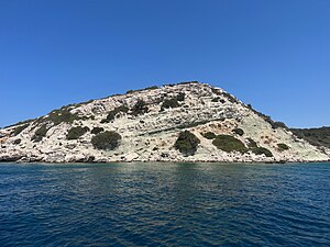 Kalem Island stratified rocks
 -
 Gap between Kalem Island south coast on right and mainland Bademli, Turkey
 -
Unfinished hotel on east coast of Kalem Island


References
edit- ^ "Kalem Adası Haritası İzmir 39° 0′ 12″ Kuzey 26° 47′ 42″ Doğu". www.haritatr.com (in Turkish). Retrieved 2024-09-09.
- ^ MERAL, Orhan (2023-12-02). "İzmir Dikili İzmir Dikili". Gezi Yorumları | Gezi-yorum.Net (in Turkish). Retrieved 2024-09-09.
External Links
edit- Oliviera Private Island Hotel - Oliveria Hotel on the island.