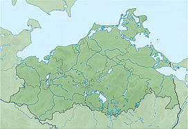
Königsstuhl (King's Chair) is the best-known chalk cliff on the Stubbenkammer in Jasmund National Park on the Baltic Sea island of Rügen. It lies at 118 m above sea level (NN).
| Königsstuhl | |
|---|---|
 Königsstuhl – seen from Victoria's View (2012) | |
| Highest point | |
| Elevation | 118 m above sea level (NN) (387 ft) |
| Coordinates | 54°34′23″N 13°39′45″E / 54.57306°N 13.66250°E |
| Geography | |
| Geology | |
| Mountain type | Chalk |

In 2004, Königsstuhl was incorporated into the terrain of Königsstuhl National Park Centre. It can be reached along a cliff top path, 11 kilometres (6.8 mi) long in total, that runs from Sassnitz to Lohme, or from the large car park in Hagen (in the municipality of Lohme) 3 km (1.9 mi) away. Since 2004, entry to the National Park Centre, and hence access to Königsstuhl, has been subject to a charge.
The narrow yet massive granite steps that lead to the plateau on Königsstuhl, 200 m2 (2,200 sq ft) in area, lie over the site of what is suspected to be a Bronze Age barrow. From the plateau there is a sweeping view of the Baltic Sea. Königsstuhl itself is best seen from the viewing point of Victoria View (Victoria-Sicht) to the south.
There is a legend that the name Königsstuhl ("King's Chair") goes back to an event in 1715 when the Swedish king Charles XII is supposed to have commanded a sea battle against the Danes from this spot. The battle tired the ruler so much that he needed to take a chair.
However, the name Königsstuhl was used in a travel report by the vicar, Rhenan, in 1586, who had been tasked by the Pomeranian duke to find mineral springs; thus it is clear that it had been named much earlier.
According to a legend, the name is actually derived from a custom whereby in ancient times the person elected king was the first to climb the cliffs from the sea and sit in the chair on the top.
-
Victoria-Sicht (Victoria's View) and Königsstuhl (King's Chair) from above
-
View towards Stubbenkammer, the area around Königsstuhl
-
View from the beach
(around 1900) -
Postcard of Königsstuhl, 1927
-
Before 1970
-
On top of Königsstuhl, at 118 m (387 ft) above sea level
-
View from Königsstuhl, northwards


