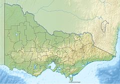
The Jordan River, a perennial river of the West Gippsland catchment, is located in the Alpine region of the Australian state of Victoria.
| Jordan | |
|---|---|
| Etymology | After the biblical River Jordan[1][2] |
| Location | |
| Country | Australia |
| State | Victoria |
| Region | Victorian Alps (IBRA), West Gippsland |
| Local government area | Shire of Baw Baw |
| Physical characteristics | |
| Source | Great Dividing Range |
| • location | near The Springs, south of Woods Point |
| • coordinates | 37°36′0″S 146°9′36″E / 37.60000°S 146.16000°E |
| • elevation | 1,170 m (3,840 ft) |
| Mouth | confluence with the Thomson River |
• location | Thomson Reservoir |
• coordinates | 37°42′14″S 146°19′32″E / 37.70389°S 146.32556°E |
• elevation | 441 m (1,447 ft) |
| Length | 22 km (14 mi) |
| Discharge | |
| • location | mouth |
| Basin features | |
| River system | West Gippsland catchment |
| Reservoir and lakes | Thomson Reservoir |
| [3] | |
Location and features
editThe Jordan River rises near The Springs, south of Woods Point, part of the Great Dividing Range. The headwaters drain a marginal area of the Big River State Forest near Jordan Gap, Jordan Cutting and McAdam Gap.[2] The river flows generally south by east, much of its course through the Thomson State Forest, before reaching its confluence with the Thomson River within the northern reaches of the Thomson Reservoir. The river descends 732 metres (2,402 ft) over its 22-kilometre (14 mi) course.[3]
The Victorian Department of Primary Industries describes the river as:[4]
- A small (5-metre (16 ft) wide) clear, fast-flowing stream running through steep forested country, rock and gravel bottom. Access limited to road crossings and forestry tracks.
European history
editThe Jordan Valley was intensively mined for gold during the latter half of the 19th and early 20th centuries.[5] As supplies were erratic and high prices were being charged, a group of businessmen from Sale posted a reward in early 1862 to cut a reliable supply track into the Jordan goldfields. Claims were made by Thomas McEvoy, Fred Porter, Archie Campbell and William Anderson, with McEvoy's Track awarded the main prize money and being the one used by most carters and miners.[6]
Several sites from this era, including the Jordan River Diversion Tunnel, are listed in the Victorian Heritage Inventory.[7][8][9][10]
The Thomson Valley - Mount Shillinglaw section of the Australian Alps Walking Track follows the Jordan River for part of its length.[11]
Etymology
editThe Jordan River was named after the biblical River Jordan (Hebrew: meaning "descending") by Owen Little in 1861 because access was "a hard road to travel".[1] Christie mentions a report in the Gippsland Times that miners thought the tree ferns further down the river reminded them of palm trees in bible illustrations, hence also the Jericho goldfield, as Jericho was "the city of palm trees" (Joshua 34:3).[2]
See also
editReferences
edit- ^ a b Blake, Les (1977). Place names of Victoria. Adelaide: Rigby. p. 294. ISBN 0-7270-0250-3., cited at Vicnames (2011)
- ^ a b c "Jordan River: 18288: Historical information". Vicnames. Government of Victoria. 12 August 2011. Archived from the original on 22 February 2014. Retrieved 13 February 2014.
- ^ a b "Map of Jordan River, VIC". Bonzle Digital Atlas of Australia. Retrieved 13 February 2014.
- ^ "Thomson River Basin - Angling Waters", A Guide to Inland Angling Waters of Victoria, Department of Primary Industries (Victoria), 17 May 2010, archived from the original on 3 December 2012, retrieved 16 September 2010
- ^ "Historic Gold Mining Sites in Gippsland Mining Division, Gazetteer: State & Regional Significant Sites", Victorian Goldfields Project, Department of Natural Resources and Environment, February 1998, archived from the original on 16 February 2010, retrieved 13 September 2010
- ^ J.G. Rogers, Jericho on the Jordan: a Gippsland Goldfield History, Moe, 1998, p. 120; J. and J. McDonald, Three William McDonalds, Canberra, 2010, pp. 154-156.
- ^ "Jordan River Diversion Tunnel, Victorian Heritage Inventory Number H8122-0041". Victorian Heritage Database. Heritage Victoria. Retrieved 13 September 2010.
- ^ "New Chum Mine, Dry Creek, Victorian Heritage Inventory Number H8122-0079". Victorian Heritage Database. Heritage Victoria. Retrieved 23 October 2011.
- ^ "Red Jacket Post Office, Victorian Heritage Inventory Number H8122-0007". Victorian Heritage Database. Heritage Victoria. Retrieved 23 October 2011.
- ^ "Red Jacket Township Site, Victorian Heritage Inventory Number H8122-0090". Victorian Heritage Database. Heritage Victoria. Retrieved 23 October 2011.
- ^ The Australian Alps Walking Track — Walhalla to Canberra, Australian Alps national parks Co-operative Management Program, 3 June 2010, retrieved 16 September 2010
External links
edit- "West Gippsland Regional Catchment Strategy (2013 - 2019)" (PDF – 4MB). West Gippsland Catchment Management Authority. 2012. ISBN 978-0-9805562-8-5.[permanent dead link]
- "Latrobe Catchment Ecosystem" (PDF). West Gippsland Catchment Management Authority. 2012. Archived from the original (PDF) on 6 April 2011.
