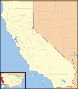
40°06′45″N 121°28′02″W / 40.11250°N 121.46722°W
Jonesville | |
|---|---|
| Coordinates: 40°06′45″N 121°28′02″W / 40.11250°N 121.46722°W | |
| Country | United States |
| State | California |
| County | Butte County |
| Elevation | 5,049 ft (1,539 m) |
Jonesville is an unincorporated community in Butte County, California. It is situated on Jones Creek, 5 miles (8.0 km) east-northeast of Butte Meadows,[2] at an elevation of 5049 feet (1539 m).
Jonesville was established in the 1860's as a hotel and way station on the Humboldt Wagon Road that connected Chico to silver mines in Idaho and Nevada. Traffic on the Humboldt Road declined after the completion of railroads, but Jonesville continued as a successful mountain resort community for vacationers escaping the severe summer heat of the Sacramento Valley.[3] The Jonesville Hotel remains standing today and was restored in 2019.[4]
References
edit- ^ U.S. Geological Survey Geographic Names Information System: Jonesville, California
- ^ Durham, David L. (1998). California's Geographic Names: A Gazetteer of Historic and Modern Names of the State. Clovis, Calif.: Word Dancer Press. p. 259. ISBN 1-884995-14-4.
- ^ "Connected Communities - History of Jonesville". Sierra Buttes Trail Stewardship. Retrieved October 2, 2023.
- ^ Sommer, Benny (August 11, 2019), "Historic Jonesville Hotel to celebrate restorations with dinner.", Chico Enterprise-Record, retrieved October 2, 2023
{{citation}}: CS1 maint: date and year (link)

