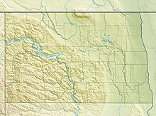
International Peace Garden Airport (FAA LID: S28) is a public use airport in Rolette County, North Dakota, United States on the Canada–US border.[1] The airport is owned by the North Dakota Aeronautics Commission and located 11 nautical miles (20 km) north of the central business district of Dunseith, North Dakota.[1] It is included in the National Plan of Integrated Airport Systems for 2011–2015, which categorized it as a general aviation facility.[3]
International Peace Garden Airport | |||||||||||
|---|---|---|---|---|---|---|---|---|---|---|---|
| Summary | |||||||||||
| Airport type | Public | ||||||||||
| Owner | North Dakota Aeronautics Commission | ||||||||||
| Serves | Dunseith, North Dakota | ||||||||||
| Location | Rolette County, North Dakota | ||||||||||
| Elevation AMSL | 2,314 ft / 705 m | ||||||||||
| Coordinates | 48°59′52″N 100°02′36″W / 48.99778°N 100.04333°W | ||||||||||
| Map | |||||||||||
 | |||||||||||
| Runways | |||||||||||
| |||||||||||
| Statistics (2011) | |||||||||||
| |||||||||||
The airport is located just east of the International Peace Garden on the North Dakota/Manitoba border. It is an airport of entry to Canada and the United States for general aviation aircraft with no more than 15 passengers and is served by adjacent US and Canadian customs stations.[2][4]
The airport is one of six airports that straddle the Canada–US border. The others are Avey Field State Airport, Whetstone International Airport, Coutts/Ross International Airport, Piney Pinecreek Border Airport, and Coronach/Scobey Border Station Airport.
Facilities and aircraft
editInternational Peace Garden Airport covers an area of 49 acres (20 ha) at an elevation of 2,314 feet (705 m) above mean sea level. It has one runway designated 11/29 with an asphalt surface measuring 3,000 by 60 feet (914 m × 18 m).[1]
For the 12-month period ending September 4, 2011, the airport had 630 aircraft operations, an average of 52 per month: 71% general aviation, 16% air taxi, and 13% military.[1]
See also
editReferences
edit- ^ a b c d e FAA Airport Form 5010 for S28 – International Peace Garden Airport[ PDF. Federal Aviation Administration. Effective November 15, 2012.
- ^ a b Dunseith/International Peace Garden Airport. Canada Flight Supplement. Effective 0901Z 16 July 2020 to 0901Z 10 September 2020..
- ^ "Appendix A of Report to Congress: National Plan of Integrated Airport Systems (NPIAS), 2011-2015" (PDF). Federal Aviation Administration. U.S. Department of Transportation. October 4, 2010. Archived from the original (PDF, 2.03 MB) on September 27, 2012.
- ^ "Port Of Entry-Dunseith". U.S. Customs and Border Protection. U.S. Department of Homeland Security. Archived from the original on 2012-10-30. Retrieved 2013-06-28.
External links
edit- International Peace Garden Airport (S28) at North Dakota Aeronautics Commission airport directory
- Page about this airport on COPA's Places to Fly airport directory
- Aerial image as of June 1995 from USGS The National Map
- Resources for this airport:
- FAA airport information for S28
- AirNav airport information for S28
- FlightAware airport information and live flight tracker
- SkyVector aeronautical chart for S28

