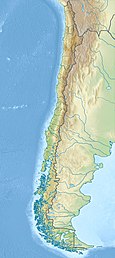
Icalma Lake is a lake of glacial origin located in the Andes of the La Araucanía Region of Chile. A hamlet on the southern shore of the lake is also called Icalma. About 3 kilometres (1.9 mi) from the hamlet is Icalma Pass, 1,307 metres (4,288 ft) in elevation and on the border with Argentina. The pass is traversed by a road, unpaved in Chile in 2017 and sometimes impassable during the Southern Hemisphere winter due to heavy snows.[2] Icalma Airport is located 9 kilometres (5.6 mi) northeast of the hamlet.
| Icalma Lake | |
|---|---|
 | |
| Coordinates | 38°48′S 71°17′W / 38.800°S 71.283°W |
| Primary inflows | Huillinco and Icalma rivers |
| Primary outflows | Rukanuco River |
| Catchment area | 150 km2 (58 sq mi)[1] |
| Basin countries | Chile |
| Max. length | 9 kilometres (5.6 mi) |
| Max. width | 2.5 kilometres (1.6 mi) |
| Surface area | 9.8 square kilometres (2,400 acres) |
| Average depth | 66 m (217 ft)[1] |
| Max. depth | 135 m (443 ft)[1] |
| Water volume | .6 cubic kilometres (490,000 acre⋅ft) |
| Surface elevation | 1,150 m (3,770 ft)[1] |
| References | [1] |
Icalma Lake is connected to the Laguna Chica de Icalma (Little Lake of Icalma) by a short stream about 300 metres (980 ft) long. The two lakes together have a surface area of 11.7 square kilometres (2,900 acres).[1] Icalma Lake drains northeastwards by way of a 10 kilometres (6.2 mi) long river named Rukanuco. Icalma Lake and nearby Galletué Lake are the sources of the Bio Bio River.[1]

Flora and Fauna
editThe most abundant species of fish in the lake is the brown trout. The lake also has a population of rainbow trout. Neither species is native to Chile.[3]
The lake and village are in the ecoregion of the Valdivian Temperate Rain Forest. The monkey-puzzle tree (Araucaria araucana) locally called "pehuen" is the most distinctive of the tree species in the forest.[4]
Climate
editUnder the Köppen climate classification, Icalma has an oceanic climate, designated Csb. Under the Trewartha climate classification the climate is Crlk: mild summers, cool winters, and humid.
| Climate data for Icalma | |||||||||||||
|---|---|---|---|---|---|---|---|---|---|---|---|---|---|
| Month | Jan | Feb | Mar | Apr | May | Jun | Jul | Aug | Sep | Oct | Nov | Dec | Year |
| Mean daily maximum °C (°F) | 24.3 (75.7) |
23.9 (75.0) |
21.3 (70.3) |
16.9 (62.4) |
11.4 (52.5) |
6.7 (44.1) |
6.6 (43.9) |
8.7 (47.7) |
12.5 (54.5) |
16.6 (61.9) |
19.5 (67.1) |
21.8 (71.2) |
16.0 (60.8) |
| Daily mean °C (°F) | 14.6 (58.3) |
14.1 (57.4) |
12.0 (53.6) |
8.6 (47.5) |
5.7 (42.3) |
3.6 (38.5) |
3.8 (38.8) |
4.5 (40.1) |
6.1 (43.0) |
8.5 (47.3) |
11.0 (51.8) |
13.0 (55.4) |
8.8 (47.8) |
| Mean daily minimum °C (°F) | 5.0 (41.0) |
4.3 (39.7) |
2.8 (37.0) |
0.4 (32.7) |
0.1 (32.2) |
0.4 (32.7) |
1.0 (33.8) |
0.4 (32.7) |
−0.2 (31.6) |
0.5 (32.9) |
2.5 (36.5) |
4.3 (39.7) |
1.6 (34.9) |
| Average precipitation mm (inches) | 28 (1.1) |
34 (1.3) |
64 (2.5) |
87 (3.4) |
200 (7.9) |
231 (9.1) |
218 (8.6) |
162 (6.4) |
99 (3.9) |
56 (2.2) |
61 (2.4) |
44 (1.7) |
1,284 (50.6) |
| Source: [5] | |||||||||||||
See also
edit- Llaima
- Sollipulli
- Bertrand, Sébastien; Charlet, François; Chapron, Emmanuel; Fagel, Nathalie; De Batist, Marc (2008). "Reconstruction of the Holocene seismotectonic activity of the Southern Andes from seismites recorded in Lago Icalma, Chile, 39°S" (PDF). Palaeogeography, Palaeoclimatology, Palaeoecology. 259 (2–3): 301–322. doi:10.1016/j.palaeo.2007.10.013. hdl:1912/2176.
References
edit- ^ a b c d e f g [1] Archived 2016-03-04 at the Wayback Machine, El Sistema Fluvial Río Bío-Bío: Area de Aplicación del Modelo
- ^ "Paso Icalma," http://www.dangerousroads.org/south-america/chile/5277-paso-icalma.html, accessed 17 Apr 2018
- ^ F. Scasso & H. Campos (2000) Pelagic Fish Communities and Eutrophication in Lakes of an Andean Basin of Central Chile, Journal of Freshwater Ecology, 15:1, 71-82, DOI:10.1080/02705060.2000.9663723,https://www.tandfonline.com/doi/pdf/10.1080/02705060.2000.9663723
- ^ "Crossing into Chile though Icalma", https://www.welcomeargentina.com/alumine/icalma-international-pass.html
- ^ "Icalma Climate Table"," Climate Data.org, https://en.climate-data.org/location/148729/, accessed 11 Apr 2018
