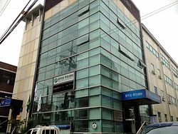
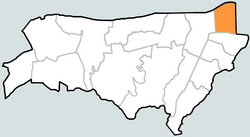
Hwanghak-dong (Korean: 황학동) is a dong (neighborhood) of Jung District, Seoul, South Korea.[2]
Hwanghak-dong | |
|---|---|
| Korean transcription(s) | |
| • Hangul | 황학동 |
| • Hanja | 黃鶴洞 |
| • Revised Romanization | Hwanghak-dong |
| • McCune–Reischauer | Hwanghak-tong |
 Hwanghak-dong Resident Office | |
 | |
| Country | South Korea |
| Area | |
• Total | 0.33 km2 (0.13 sq mi) |
| Population (2013[1]) | |
• Total | 12,238 |
| • Density | 37,000/km2 (96,000/sq mi) |
Etymology
editThe exact origin of the name "Hwanghak-dong" is unclear. However, as documented in the "Daegyungseongjeongdo" from 1936, it is suggested that during that period, the area was predominantly fields, and the name "Hwanghak" was associated with a sudden appearance, possibly linked to this context. Furthermore, there exists an ancient natural slope known as "Baekhak-dong" within the present Sindang 5-dong vicinity, leading to speculation that the name "Hwanghak-dong" was coined in contrast to it.
Attractions
editTransportation
editSee also
editReferences
edit- ^ 월별인구통계 | 중구통계. Archived from the original on September 28, 2013. Retrieved September 15, 2013.
- ^ 황학동 Hwanghak-dong 黃鶴洞 (in Korean). Retrieved 2008-05-07.[permanent dead link]
- "Chronicle of Beopjeong-dong and Haengjeong-dong" (in Korean). Guro District Official website. Archived from the original on 2014-10-06. Retrieved 2008-05-07.
- "Mapo Information". The chart of Beopjeong-dong assigned by Haengjeong-dong (행정동별 관할 법정동 일람표) (in Korean). Mapo District Official website. Archived from the original on 2007-11-05.
External links
edit- Jung-gu Official site in English
- (in Korean) Jung-gu Official site[permanent dead link]
- (in Korean) Jung-gu Tour Guide from the Official site
- (in Korean) Status quo of Jung-gu
- (in Korean) Resident offices and maps of Jung-gu[dead link]
- (in Korean) Hwanghak-dong resident office website