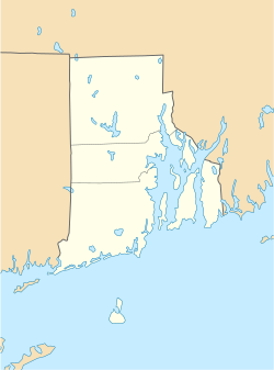
Hopkinton is a census-designated place (CDP) in Washington County, Rhode Island, United States, comprising the central village in the town of Hopkinton. It was first listed as a CDP prior to the 2020 census.[3] The village is also known as Hopkinton City, and the center of the village comprises the Hopkinton City Historic District.
Hopkinton, Rhode Island
Hopkinton City | |
|---|---|
| Coordinates: 41°27′41″N 71°46′40″W / 41.46139°N 71.77778°W | |
| Country | United States |
| State | Rhode Island |
| County | Washington |
| Town | Hopkinton |
| Area | |
• Total | 3.31 sq mi (8.57 km2) |
| • Land | 3.30 sq mi (8.55 km2) |
| • Water | 0.01 sq mi (0.01 km2) |
| Elevation | 170 ft (50 m) |
| Population | |
• Total | 475 |
| • Density | 143.85/sq mi (55.54/km2) |
| Time zone | UTC-5 (Eastern (EST)) |
| • Summer (DST) | UTC-4 (EDT) |
| ZIP Codes | |
| Area code | 401 |
| FIPS code | 44-35200 |
| GNIS feature ID | 2631335[3] |
Hopkinton village is on the western edge of Washington County, in the west-central part of the town of Hopkinton. Its western border is the Connecticut state line. Rhode Island Route 3 passes through the center of the village, leading northeast 4 miles (6 km) to Hope Valley, the largest village in the town of Hopkinton, and south 3 miles (5 km) to Ashaway, the second-largest village. Interstate 95 runs through the southeastern part of the Hopkinton CDP, with access from Exit 1 with Route 3 between Hopkinton village and Ashaway. I-95 leads northeast 36 miles (58 km) to Providence, the state capital, and southwest 19 miles (31 km) to New London, Connecticut.
Demographics
edit| Census | Pop. | Note | %± |
|---|---|---|---|
| 2020 | 475 | — | |
| U.S. Decennial Census[4] | |||
2020 census
editThe 2020 United States census counted 475 people, 212 households, and 152 families in Hopkinton. The population density was 143.9 per square mile (55.5/km2). There were 226 housing units at an average density of 68.4 per square mile (26.4/km2).[5][6] The racial makeup was 91.16% (433) white or European American (90.74% non-Hispanic white), 0.84% (4) black or African-American, 0.63% (3) Native American or Alaska Native, 0.42% (2) Asian, 0.0% (0) Pacific Islander or Native Hawaiian, 1.05% (5) from other races, and 5.89% (28) from two or more races.[7] Hispanic or Latino of any race was 3.37% (16) of the population.[8]
Of the 212 households, 21.2% had children under the age of 18; 38.2% were married couples living together; 27.4% had a female householder with no spouse or partner present. 46.2% of households consisted of individuals and 27.8% had someone living alone who was 65 years of age or older.[5] The average household size was 2.2 and the average family size was 3.1.[9] The percent of those with a bachelor's degree or higher was estimated to be 19.6% of the population.[10]
13.7% of the population was under the age of 18, 9.5% from 18 to 24, 20.8% from 25 to 44, 22.7% from 45 to 64, and 33.3% who were 65 years of age or older. The median age was 50.3 years. For every 100 females, the population had 122.0 males.[5] For every 100 females ages 18 and older, there were 129.1 males.[5]
References
edit- ^ "ArcGIS REST Services Directory". United States Census Bureau. Retrieved October 12, 2022.
- ^ "Census Population API". United States Census Bureau. Retrieved October 12, 2022.
- ^ a b "Hopkinton Census Designated Place". Geographic Names Information System. United States Geological Survey, United States Department of the Interior.
- ^ "Census of Population and Housing". Census.gov. Retrieved June 4, 2016.
- ^ a b c d "US Census Bureau, Table DP1: PROFILE OF GENERAL POPULATION AND HOUSING CHARACTERISTICS". data.census.gov. Retrieved December 29, 2023.
- ^ "Gazetteer Files". Census.gov. United States Census Bureau. Retrieved December 30, 2023.
- ^ "US Census Bureau, Table P1: RACE". data.census.gov. Retrieved December 29, 2023.
- ^ "US Census Bureau, Table P2: HISPANIC OR LATINO, AND NOT HISPANIC OR LATINO BY RACE". data.census.gov. Retrieved December 29, 2023.
- ^ "US Census Bureau, Table S1101: HOUSEHOLDS AND FAMILIES". data.census.gov. Retrieved December 29, 2023.
- ^ "US Census Bureau, Table S1501: EDUCATIONAL ATTAINMENT". data.census.gov. Retrieved December 29, 2023.

