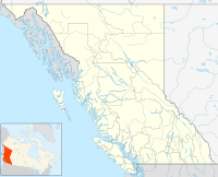
Hixon is an unincorporated community 2.48 square kilometres in size[1] at the northern edge of the Cariboo region of the Central Interior region of British Columbia, Canada. It is part of Electoral Area E in the Regional District of Fraser-Fort George.[2] It is located on the east (left) bank of the Fraser River, and is about midway along BC Highway 97 between the cities of Prince George (N) and Quesnel (S). It was named for Hixon Creek, which in turn is named for a 19th-century prospector in the area, by the name of Joseph Foster Hixon, who found gold here on the banks of the Fraser River back around 1866. As of 2021, it has a population of 239, representing a 13.7 percent decline from 2016.[1]
Climate
edit| Climate data for Hixon | |||||||||||||
|---|---|---|---|---|---|---|---|---|---|---|---|---|---|
| Month | Jan | Feb | Mar | Apr | May | Jun | Jul | Aug | Sep | Oct | Nov | Dec | Year |
| Record high °C (°F) | 14.0 (57.2) |
14.0 (57.2) |
20.0 (68.0) |
31.1 (88.0) |
37.5 (99.5) |
34.5 (94.1) |
36.1 (97.0) |
36.5 (97.7) |
35.5 (95.9) |
26.5 (79.7) |
17.0 (62.6) |
11.0 (51.8) |
37.5 (99.5) |
| Mean daily maximum °C (°F) | −2.9 (26.8) |
0.9 (33.6) |
6.8 (44.2) |
13.0 (55.4) |
18.2 (64.8) |
21.6 (70.9) |
24.1 (75.4) |
23.9 (75.0) |
18.4 (65.1) |
10.5 (50.9) |
1.7 (35.1) |
−2.4 (27.7) |
11.2 (52.2) |
| Daily mean °C (°F) | −6.7 (19.9) |
−3.8 (25.2) |
0.7 (33.3) |
5.9 (42.6) |
10.8 (51.4) |
14.5 (58.1) |
16.7 (62.1) |
16.2 (61.2) |
11.6 (52.9) |
5.4 (41.7) |
−1.6 (29.1) |
−5.8 (21.6) |
5.3 (41.5) |
| Mean daily minimum °C (°F) | −10.5 (13.1) |
−8.6 (16.5) |
−5.3 (22.5) |
−1.3 (29.7) |
3.3 (37.9) |
7.4 (45.3) |
9.2 (48.6) |
8.5 (47.3) |
4.7 (40.5) |
0.3 (32.5) |
−4.9 (23.2) |
−9.3 (15.3) |
−0.5 (31.1) |
| Record low °C (°F) | −44.0 (−47.2) |
−39.4 (−38.9) |
−30.0 (−22.0) |
−15.0 (5.0) |
−6.1 (21.0) |
−1.0 (30.2) |
1.0 (33.8) |
−2.5 (27.5) |
−6.0 (21.2) |
−26.5 (−15.7) |
−35.5 (−31.9) |
−40.5 (−40.9) |
−44.0 (−47.2) |
| Average precipitation mm (inches) | 64.5 (2.54) |
32.2 (1.27) |
32.7 (1.29) |
36.7 (1.44) |
46.2 (1.82) |
68.5 (2.70) |
70.5 (2.78) |
47.3 (1.86) |
57.9 (2.28) |
66.4 (2.61) |
63.4 (2.50) |
58.8 (2.31) |
645.0 (25.39) |
| Average rainfall mm (inches) | 12.3 (0.48) |
7.6 (0.30) |
14.9 (0.59) |
31.5 (1.24) |
45.5 (1.79) |
68.5 (2.70) |
70.5 (2.78) |
47.3 (1.86) |
57.9 (2.28) |
59.5 (2.34) |
28.2 (1.11) |
8.8 (0.35) |
452.4 (17.81) |
| Average snowfall cm (inches) | 52.2 (20.6) |
24.6 (9.7) |
17.9 (7.0) |
5.2 (2.0) |
0.7 (0.3) |
0.0 (0.0) |
0.0 (0.0) |
0.0 (0.0) |
0.0 (0.0) |
6.9 (2.7) |
35.2 (13.9) |
50.0 (19.7) |
192.6 (75.8) |
| Average precipitation days (≥ 0.2 mm) | 14.6 | 10.4 | 11.2 | 10.9 | 14.3 | 15.9 | 15.4 | 12.8 | 13.4 | 16.2 | 15.4 | 13.9 | 164.3 |
| Average rainy days (≥ 0.2 mm) | 3.7 | 3.8 | 6.7 | 9.4 | 14.1 | 15.9 | 15.4 | 12.8 | 13.4 | 14.9 | 8.1 | 2.9 | 121.0 |
| Average snowy days (≥ 0.2 cm) | 12.3 | 7.5 | 6.3 | 2.2 | 0.3 | 0.0 | 0.0 | 0.0 | 0.0 | 2.4 | 9.5 | 11.8 | 52.3 |
| Source: [3] | |||||||||||||
References
edit- ^ a b Statistics Canada (1 February 2023). "Census Profile, 2021 Census of Population Profile table". Statistics Canada. Retrieved 13 June 2023.
- ^ "Woodpecker – Hixon – RDFFG".
- ^ "Calculation Information for 1981 to 2010 Canadian Normals Data". Environment Canada. Archived from the original on 18 February 2014. Retrieved 9 July 2013.
53°25′12″N 122°35′09″W / 53.42000°N 122.58583°W
