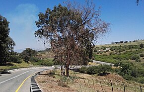
Highway 91 is an east-west highway in northern Israel and the Golan Heights. It extends through the Jordan Rift Valley and the central Golan Heights. It begins in the west at Mahanayim junction with Highway 90, and it ends in the east at Zivan junction near the Israeli settlement Ein Zivan, where it meets Highway 98. The road is 28 km long.
| Highway 91 | ||||
|---|---|---|---|---|
| כביש 91 | ||||
 Bnot Yaakov bridge over the Jordan River | ||||
| Route information | ||||
| Length | 29.71 km (18.46 mi) | |||
| Major junctions | ||||
| West end | Mahanayim Junction | |||
| East end | Zivan Junction | |||
| Location | ||||
| Country | Israel | |||
| Highway system | ||||
| ||||
Junctions & Interchanges (West to East)
edit| District[1] | Location[2] | km | mi | Name | Destinations | Notes |
|---|---|---|---|---|---|---|
| Northern | Mahanayim | 0.00 | 0.00 | צומת מחניים (Mahanayim Junction) | Highway 90 | |
| Mishmar HaYarden | 4.21 | 2.62 | מסעף משמר הירדן (Mishmar HaYarden Branch) | HaMoshava Street | ||
| Gadot | 6.76 | 4.20 | צומת גדות (Gadot Junction) | Route 918 | ||
| Customs office | 12.01 | 7.46 | צומת בית המכס (Customs House Junction) | Route 888 | ||
| Katzrin | 14.69 | 9.13 | צומת נשוט (Nashut Junction) | Road 9088 | ||
| Kidmat Tzvi | 20.19 | 12.55 | מחנה עוז (Oz Camp) | Road 9098 | ||
| Camp Yitzhak | 21.64 | 13.45 | צומת נפח (Naffakh Junction) | Petroleum Road | ||
| Ruins of Kafr Naffakh | 22.97 | 14.27 | צומת השריון (HaShiryon Junction) | Route 978 | ||
| Ortal | 26.37 | 16.39 | מסעף אורטל (Ortal Branch) | Road 9884 | ||
| Mount Avital | 27.98 | 17.39 | צומת אביטל (Avital Junction) | Road 9881 | ||
| Ein Zivan | 29.71 | 18.46 | צומת זיוון (Zivan Junction) | Highway 98 | ||
| 1.000 mi = 1.609 km; 1.000 km = 0.621 mi | ||||||
Places of interest near Highway 91
edit- Memorial for Mishmar HaYarden
- Bnot Ya'akov Bridge
- Chief customs office (?)
- Memorial for the IDF 188th brigade
References
edit- ^ Survey of Israel (October 31, 2018). "מחוזות משרד הפנים" [Ministry of Interior districts] (Map). Govmap (in Hebrew). Retrieved October 31, 2018.
- ^ Survey of Israel (October 31, 2018). "גבולות ישובים" [Locality borders] (Map). Govmap (in Hebrew). Retrieved October 31, 2018.

