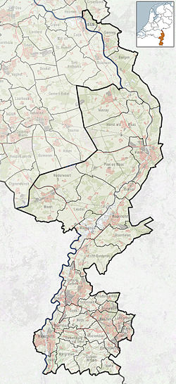
Heythuysen (Dutch: [ˈɦɛitˌɦœyzə(n)] ; Limburgish: Heitse) is a town in the south-eastern Netherlands.
Heythuysen
Heitse (Limburgish) | |
|---|---|
Village | |
 Retirement home and former monastery of the White Fathers of St Charles | |
| Coordinates: 51°15′N 5°54′E / 51.250°N 5.900°E | |
| Country | Netherlands |
| Province | Limburg |
| Municipality | Leudal |
| Area | |
• Total | 27.55 km2 (10.64 sq mi) |
| Elevation | 28 m (92 ft) |
| Population (2021)[1] | |
• Total | 6,545 |
| • Density | 240/km2 (620/sq mi) |
| Time zone | UTC+1 (CET) |
| • Summer (DST) | UTC+2 (CEST) |
| Postal code | 6093[1] |
| Dialing code | 0475 |
| Major roads | N279 |
History
editIt was first mentioned in 1383 as Heythusen, and means "houses on the heath". It was located on the road from Venlo to Antwerp,[3] and between the Bevelandse beek and the Tungelroyse beek.[4] In 1243, it became a border town for the County of Horne. In 1680, Heythuysen became an independent heerlijkheid.[3]
The Catholic St Nicolaas Church is a three-aisled church which was built shortly after 1504. In 1847, the current Gothic Revival tower was built. In 1927, the church was enlarged.[4]
Heythuysen was home to 275 people in 1840.[5] Until it became a part of Leudal on 1 January 2007, Heythuysen was a separate municipality, including the villages of Baexem, Grathem and Kelpen-Oler.[5] Heythuysen is home of the Grand Café Tom Tom.
Gallery
edit-
Windmill: de Sint Antoniusmolen
-
Building in Heythuysen
-
St Nicolaas Church
-
School in Heythuysen
References
edit- ^ a b c "Kerncijfers wijken en buurten 2021". Central Bureau of Statistics. Retrieved 25 April 2022.
- ^ "Postcodetool for 6093AA". Actueel Hoogtebestand Nederland (in Dutch). Het Waterschapshuis. Retrieved 25 April 2022.
- ^ a b "Heythuysen - (geografische naam)". Etymologiebank (in Dutch). Retrieved 25 April 2022.
- ^ a b Sabine Broekhoven, & Ronald Stenvert (2003). Heythuysen (in Dutch). Zwolle: Waanders. ISBN 90 400 9623 6. Retrieved 25 April 2022.
- ^ a b "Heythuysen". Plaatsengids (in Dutch). Retrieved 25 April 2022.

