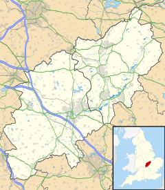
Hargrave is a small village and civil parish situated in rural Northamptonshire, England, approximately 21 miles east of Northampton and adjacent to the Northamptonshire-Cambridgeshire-Bedfordshire border. At the time of the 2001 census, the parish's population was 236 people,.[1] increasing to 241 at the 2011 census.[2]
| Hargrave | |
|---|---|
Location within Northamptonshire | |
| Population | 241 (2011) |
| OS grid reference | TL0370 |
| Unitary authority | |
| Ceremonial county | |
| Region | |
| Country | England |
| Sovereign state | United Kingdom |
| Post town | Wellingborough |
| Postcode district | NN9 |
| Dialling code | 01933 |
| Police | Northamptonshire |
| Fire | Northamptonshire |
| Ambulance | East Midlands |
| UK Parliament | |
The villages name origin is uncertain. 'The hare grove', 'hoar grove' or in a transferred sense of Old English 'har', 'boundary grove' which it could potentially be because the parish borders both Cambridgeshire and Bedfordshire.[3]
The 12th century, All Hallows Church is at the centre of the village. The village has a village hall with several active societies.
In 2007, Hargrave, Raunds, Ringstead and Stanwick were legally united as "The 4 Spires Benefice", with each village retaining its own church.[4]
Heritage assets
editThe following buildings and structures are listed by Historic England as of special architectural or historic interest.[5]
- Church of All Saints and chest tomb (Grade II*) 12th century 52°19′27″N 0°28′50″W / 52.32406°N 0.48046°W
- Stone coffin, Church of All Saints (Grade II) 13th century 52°19′26″N 0°28′49″W / 52.32399°N 0.48036°W
- Churchlands (Grade II) 17th century 52°19′27″N 0°28′53″W / 52.32406°N 0.48134°W
- Wildacre (Grade II) 17th century 52°19′34″N 0°29′07″W / 52.32612°N 0.48537°W
- Pair of chest tombs (Grade II) 17th century 52°19′26″N 0°28′50″W / 52.32393°N 0.48050°W
- Nag's Head public house (Grade II) 17th century 52°19′28″N 0°28′48″W / 52.32441°N 0.47989°W
- Box Tree Cottage and attached house (Grade II) 17th century 52°19′28″N 0°28′50″W / 52.32451°N 0.48065°W
- Group of three chest tombs (Grade II) 18th century 52°19′27″N 0°28′49″W / 52.32408°N 0.48020°W
- Hillstone Cottage (Grade II) 18th century 52°19′50″N 0°29′12″W / 52.33059°N 0.48670°W
- War memorial (Grade II) 20th century 52°19′26″N 0°28′48″W / 52.32388°N 0.48013°W
Geography
editRingstead, Keyston, Stanwick, Rushden, Higham Ferrers, Thrapston, Raunds, Wellingborough, Chelveston, Irthlingborough, Upper Dean, Shelton and Covington are places near Hargrave.
Demography
editReferences
edit- ^ Office for National Statistics: Hargrave CP: Parish headcounts. Retrieved 12 November 2009
- ^ "Civil Parish population 2011". Neighbourhood Statistics. Office for National Statistics. Retrieved 4 July 2016.
- ^ "Key to English Place-names".
- ^ "4 Spires Benefice". Retrieved 11 September 2015.
- ^ National Heritage List for England (Historic England)
- ^ a b c William Whellan & Co. (1849). History, Gazetteer and Directory Northamptonshire. Whittaker & Co. p. 885.
- ^ a b Office for National Statistics
External links
editMedia related to Hargrave, Northamptonshire at Wikimedia Commons
