This article needs additional citations for verification. (April 2013) |
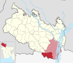
Gobindaganj (Bengali: গোবিন্দগঞ্জ) is an Upazila of Gaibandha District and the Division of Rangpur.[4] It is one of the largest upazila in Bangladesh including 17 unions and 1 municipality.
Gobindaganj Upazila
গোবিন্দগঞ্জ উপজেলা | |
|---|---|
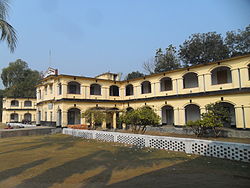
 Mahimaganj Alia Kamil Madrasha, Mahimaganj, Gobindaganj | |
 | |
| Coordinates: 25°8′N 89°23.5′E / 25.133°N 89.3917°E | |
| Country | |
| Division | Rangpur |
| District | Gaibandha |
| Area | |
• Total | 460.42 km2 (177.77 sq mi) |
| Population | |
• Total | 543,144 |
| • Density | 1,200/km2 (3,100/sq mi) |
| Time zone | UTC+6 (BST) |
| Postal code | 5740[2] |
| Area code | 0541[3] |
| Website | gobindaganj |
Geography
editGobindaganj is located at 25°08′00″N 89°23′30″E / 25.1333°N 89.3917°E. It has 132,572 households and total area 460.42 km2.
Demographics
editAccording to the 2011 Census of Bangladesh, Gobindaganj Upazila had 132,572 households and a population of 514,696. 119,767 (23.27%) were under 10 years of age. Gobindaganj had a literacy rate (age 7 and over) of 42.59%, compared to the national average of 51.8%, and a sex ratio of 1013 females per 1000 males. 38,415 (7.46%) lived in urban areas.[6] Ethnic population was 3,351 (0.65%), of which Santal were 3,086.[7]
As of the 1991 Bangladesh census, Gobindaganj has a population of 414591. Males constitute are 50.89% of the population, and females 49.11%. This Upazila's eighteen up population is 205,204. Gobindaganj has an average literacy rate of 23.1% (7+ years), and the national average of 32.4% literate.[8]
Administration
editGobindaganj Upazila is divided into Gobindaganj Municipality and 17 union parishads: Kamdia, Katabari, Shakhahar, Razahar, Sapmara, Darbosta, Taluk Kanupur, Nakai, Harirampur, Rakhalbururz, Fulbari, Gumanigonj, Kamardaha, Kocha Shahar, Shibpur, Mahimaganj, Shalmara. The union parishads are subdivided into 339 mauzas and 375 villages.[6]
Gobindaganj Municipality is subdivided into 9 wards and 22 mahallas.[6]
In terms of total area and number of unions, it is the second largest upazila in Bangladesh. It is called the nucleus of Rangpur Division. It has 13 branches of different banks and 11 colleges as well.
Government
editEconomy
edit1. Small Cottage Industries (Kocha Shahar).
2. Rangpur Sugar Mills Limited (Mahimaganj).
3. Agriculture (Rice & paddy, sugarcane, fisheries, and cattle rearing)
4. Business and others. 5. 001
Education
editAccording to Banglapedia, Gobindagonj Multilateral High School, founded in 1912, is a notable secondary school.[4]
Literacy rate and educational institutions Average literacy 37.8%; male 42.9%, female 32.5%. Educational institutions: college 13, technical college 1, law college 1, teachers training college 1, secondary school 72, primary school 239, madrasa 153. Noted educational institutions: Gobindaganj Degree College (1965), Kamdia Nurul Haque Degree College (1972), Mahimaganj Degree College (1972), Gobindaganj Mahila College (1991), Nakaihat College, Mahimaganj Women College, Phulpukuria College, Shamim & Shakil Technical College, Akramul Haque Computer and ideal College, Shohorgachhi Adarsa Degree College, Gobindaganj Multilateral High School (1912), Kamdia Bilateral High School (1921), Gobindaganj BM Girls' High School (1940), Rangpur Sugar Mills High School (1962), Birat High School (1964), Shahargachhi Girls' High School (1971), Mahimaganj Alia Madrasa (1937), Mahimagonj high School(1945),Chandpara Alim Madrasa (1963), Chandpara Bi-Lateral High School (1965), Kocha Shahar Bi-Lateral High School (1962), Kocha Shahar Shilpanagori College o Goveshona Kendra (2002).
References
edit- ^ National Report (PDF). Population and Housing Census 2022. Vol. 1. Dhaka: Bangladesh Bureau of Statistics. November 2023. p. 403. ISBN 978-9844752016.
- ^ "Bangladesh Postal Code". Dhaka: Bangladesh Postal Department under the Department of Posts and Telecommunications of the Ministry of Posts, Telecommunications and Information Technology of the People's Republic of Bangladesh. 21 October 2024.
- ^ "Bangladesh Area Code". China: Chahaoba.com. 18 October 2024.
- ^ a b Nandi, Bishnu (2012). "Gobindaganj Upazila". In Islam, Sirajul; Jamal, Ahmed A. (eds.). Banglapedia: National Encyclopedia of Bangladesh (Second ed.). Asiatic Society of Bangladesh.
- ^ Population and Housing Census 2022 - District Report: Gaibandha (PDF). District Series. Dhaka: Bangladesh Bureau of Statistics. June 2024. ISBN 978-984-475-228-3.
- ^ a b c "Bangladesh Population and Housing Census 2011 Zila Report – Gaibandha" (PDF). bbs.gov.bd. Bangladesh Bureau of Statistics.
- ^ "Community Tables: Gaibandha district" (PDF). bbs.gov.bd. Bangladesh Bureau of Statistics. 2011.
- ^ "Population Census Wing, BBS". Archived from the original on 2005-03-27. Retrieved November 10, 2006.