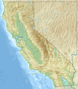
Goat Mountain is a 12,207-foot-elevation (3,721-meter) mountain summit located in Kings Canyon National Park, in Fresno County of northern California, United States.[3] It is situated on Monarch Divide which is west of the crest of the Sierra Nevada mountain range. Topographic relief is significant as the southeast aspect rises 5,600 feet (1,700 meters) above Paradise Valley in 2.5 miles. This feature was so named because mountain sheep, erroneously called goats, were once seen on the slopes.[4] The name was already in use when the first ascent of the summit was made in 1896 by Joseph Nisbet LeConte and party.[5] This mountain's name has been officially adopted by the United States Board on Geographic Names.[3]
| Goat Mountain | |
|---|---|
 Northeast aspect | |
| Highest point | |
| Elevation | 12,207 ft (3,721 m)[1] |
| Prominence | 927 ft (283 m)[1] |
| Parent peak | Dougherty Peak (12,241 ft)[2] |
| Isolation | 3.89 mi (6.26 km)[2] |
| Listing | Sierra Peaks Section |
| Coordinates | 36°52′10″N 118°34′27″W / 36.8694694°N 118.5742113°W[3] |
| Geography | |
| Location | Kings Canyon National Park Fresno County, California, U.S. |
| Parent range | Sierra Nevada |
| Topo map | USGS The Sphinx |
| Geology | |
| Rock age | Cretaceous |
| Mountain type | Fault block |
| Rock type | granitic |
| Climbing | |
| First ascent | 1896 |
| Easiest route | class 2[2] |
Climate
editAccording to the Köppen climate classification system, Goat Mountain is located in an alpine climate zone.[6] Most weather fronts originate in the Pacific Ocean, and travel east toward the Sierra Nevada mountains. As fronts approach, they are forced upward by the peaks, causing them to drop their moisture in the form of rain or snowfall onto the range (orographic lift). Precipitation runoff from this mountain drains into tributaries of the South Fork Kings River.
See also
editReferences
edit- ^ a b "Goat Mountain, California". Peakbagger.com. Retrieved 2021-05-29.
- ^ a b c "Goat Mountain - 12,207' CA". listsofjohn.com. Retrieved 2021-05-29.
- ^ a b c "Goat Mountain". Geographic Names Information System. United States Geological Survey, United States Department of the Interior. Retrieved 2021-05-29.
- ^ Peter Browning, Place Names of the Sierra Nevada: From Abbot to Zumwalt, Wilderness Press, 1986, ISBN 9780899970479, page 82.
- ^ Francis P. Farquhar, Place Names of the High Sierra (1926)
- ^ Peel, M. C.; Finlayson, B. L.; McMahon, T. A. (2007). "Updated world map of the Köppen−Geiger climate classification". Hydrol. Earth Syst. Sci. 11. ISSN 1027-5606.
External links
edit- Weather forecast: National Weather Service

