
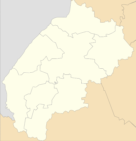
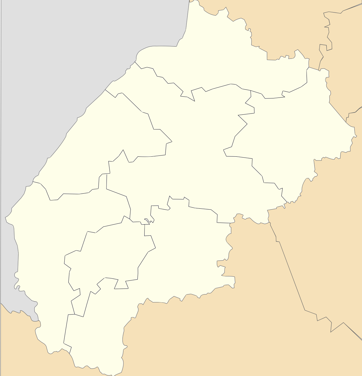
Size of this PNG preview of this SVG file: 578 × 599 pixels. Other resolutions: 231 × 240 pixels | 463 × 480 pixels | 741 × 768 pixels | 988 × 1,024 pixels | 1,976 × 2,048 pixels | 1,227 × 1,272 pixels.
Original file (SVG file, nominally 1,227 × 1,272 pixels, file size: 55 KB)
| This is a file from the Wikimedia Commons. Information from its description page there is shown below. Commons is a freely licensed media file repository. You can help. |
Summary
| Description |
Русский: Районы Львовской области с 17 июля 2020 года.
Українська: Райони Львівської області від 17 липня 2020 року. |
| Date | |
| Source | Own work |
| Author | RosssW |
Licensing
I, the copyright holder of this work, hereby publish it under the following license:
This file is licensed under the Creative Commons Attribution-Share Alike 4.0 International license.
- You are free:
- to share – to copy, distribute and transmit the work
- to remix – to adapt the work
- Under the following conditions:
- attribution – You must give appropriate credit, provide a link to the license, and indicate if changes were made. You may do so in any reasonable manner, but not in any way that suggests the licensor endorses you or your use.
- share alike – If you remix, transform, or build upon the material, you must distribute your contributions under the same or compatible license as the original.
File history
Click on a date/time to view the file as it appeared at that time.
| Date/Time | Thumbnail | Dimensions | User | Comment | |
|---|---|---|---|---|---|
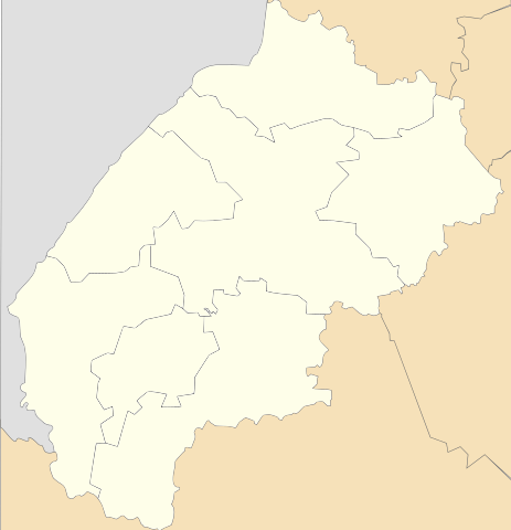
| current | 21:59, 14 September 2023 | | 1,227 × 1,272 (55 KB) | Arvedui89 | proper Poland - Transcarpathia border |
| 13:57, 20 August 2020 |  | 1,227 × 1,272 (55 KB) | RosssW | Uploaded own work with UploadWizard |
File usage
More than 100 pages use this file. The following list shows the first 100 pages that use this file only. A full list is available.
- Belz
- Bibrka
- Bratkovychi
- Brody
- Brody Air Base
- Busk, Ukraine
- Dobrianychi
- Dobromyl
- Dominican Church, Lviv
- Drohobych
- Dubie, Lviv Oblast
- Dubliany, Lviv Raion, Lviv Oblast
- Hai-Ditkovetski
- Hlushyn
- Hlyniany
- Holubytsia
- Kamianka-Buzka
- Khodoriv
- Khyriv
- Klekotiv
- Komarivka, Lviv Oblast
- Komarno, Ukraine
- Lviv railway station
- Makhlynets
- Medenychi
- Monastery and church of St. Onuphrius, Lviv
- Morshyn
- Mostyska
- Mykolaiv, Lviv Oblast
- Nemyriv, Lviv Oblast
- Novoiavorivsk
- Novyi Kalyniv
- Novyi Rozdil
- Olesko
- Peniaky
- Peremyshliany
- Pidhirtsi
- Pidkamin
- Ponykovytsia
- Ponykva
- Popivtsi
- Pustomyty
- Radekhiv
- Rava-Ruska
- Razhniv
- Ruda-Bridska
- Rudky
- Rykhtychi
- Salashka
- Sambir
- Selets
- Shnyriv
- Shpaky
- Shyshkivtsi, Lviv Oblast
- Sianky
- Skelivka
- Skole
- Slavske
- Smilne
- Sokal
- Sosnivka
- Stanislavchyk
- Stare Selo
- Staryi Sambir
- Stebnyk
- Stryi
- Stryi Air Base
- Strykhaliuky
- Styborivka
- Sudova Vyshnia
- Sukhodoly
- Sukhota
- Sukhovolia, Zolochiv Raion, Lviv Oblast
- Sydynivka
- Sytykhiv
- Terebezhi
- Tetylkivtsi
- Trishchuky
- Truskavets
- Turka, Ukraine
- Uhniv
- Velyki Mosty
- Velyki Perelisky
- Velyn
- Verbivchyk
- Vovkovatytsia
- Vydra, Ukraine
- Vynnyky
- Vysotsko
- Yablunivka
- Yavoriv
- Yazlivchyk
- Zabolottsi, Lviv Oblast
- Zahirtsi
- Zalissia, Zolochiv Raion, Lviv Oblast
- Zavyshen
- Zbrui
- Zharkiv
- Zhovkva
- Zhydachiv
View more links to this file.
Global file usage
The following other wikis use this file:
- Usage on be-tarask.wiki.x.io
- Usage on be.wiki.x.io
- Буск
- Львоў
- Мыкалаіў (Львоўская вобласць)
- Трускавец
- Аблазныця
- Вэлыкы Любінь
- Вэлыкі Мосты
- Самбар
- Барыслаў
- Дубляны (горад)
- Шаблон:На карце/Украіна Львоўская вобласць
- Моршын
- Вынныкы
- Брухавычы
- Жоўква
- Рудна
- Кам’янка-Бузька
- Радэхіў
- Сколэ
- Дубляны (Самбірскі раён)
- Золачыў (Львоўская вобласць)
- Алэска
- Рава-Руская
- Бэлз
- Підгірці (Бродыўскі раён)
- Вэрхне Сынявыднэ
- Сакаль
- Наваяварыўск
- Пустомыты
- Глыняны (Львоўская вобласць)
- Стэбнык
- Бібрка
- Памараны
- Ходарыў
- Дабромыль
- Борыня
- Гніздычыў
- Жыдачыў
- Яварыў
- Угніў
- Мастыска
- Рудкы
- Новы Ярычыў
- Новы Калыніў
- Жвырка
- Підбуж
- Підкамінь
- Шчырэць
- Пэрэмышляны
View more global usage of this file.