Eyebrow (2016 population: 119) is a village in the Canadian province of Saskatchewan within the Rural Municipality of Eyebrow No. 193 and Census Division No. 7. The community originated at the location that is now the abandoned community of Eskbank several kilometres to the south. Eyebrow is located at the intersection of Highway 367 and Highway 42; 84 km northwest of Moose Jaw, 154 km northwest of Regina and 196 km south of Saskatoon.
Eyebrow | |
|---|---|
| Village of Eyebrow | |
 | |
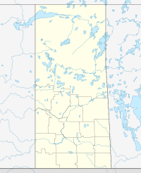
Location of Eyebrow in Saskatchewan | |
| Coordinates: 50°43′55″N 106°11′06″W / 50.732°N 106.185°W | |
| Country | |
| Province | |
| Region | South-central |
| Census division | 7 |
| Rural Municipality | Eyebrow |
| Post office Founded | 1908 |
| Government | |
| • Type | Municipal |
| • Governing body | Eyebrow Village Council |
| • Mayor | Orlando Bueckert |
| • Administrator | Deanne Hartell |
| Area | |
• Total | 2.70 km2 (1.04 sq mi) |
| Population (2016) | |
• Total | 119 |
| • Density | 50.0/km2 (129/sq mi) |
| Time zone | UTC-6 (CST) |
| Postal code | S0H 1L0 |
| Area code | 306 |
| Highways | |
| Railways | Canadian Pacific Railway |
| [1][2][3][4] | |
History
editA post office was established in 1904 called Eyebrow Hill located just south in Sec.12, Twp.20, R.2, W3 of the Dominion Land Survey. Eyebrow Hill was renamed Eskbank in 1908. The post office of Eyebrow Station (Sec.24, Twp.21, R.2, W3) was established in 1908 then was renamed Eyebrow six months later.[1] Eyebrow incorporated as a village on January 8, 1909.[5]
Geography
editThe Eyebrow Hills and Eye Lake are located north of the village (not to be confused with Eyebrow Lake located in the Qu'Appelle Valley near the village of Tugaske).[6]
Demographics
editIn the 2021 Census of Population conducted by Statistics Canada, Eyebrow had a population of 130 living in 62 of its 73 total private dwellings, a change of 9.2% from its 2016 population of 119. With a land area of 2.52 km2 (0.97 sq mi), it had a population density of 51.6/km2 (133.6/sq mi) in 2021.[9]
In the 2016 Census of Population, the Village of Eyebrow recorded a population of 119 living in 60 of its 61 total private dwellings, a -16.8% change from its 2011 population of 139. With a land area of 2.7 km2 (1.0 sq mi), it had a population density of 44.1/km2 (114.2/sq mi) in 2016.[10]
Activities
editThe ERHL or Eyebrow Recreation Hockey League is a local outdoor hockey league consisting of three teams: the Blazers, Puck Hogs and Eskimos. Former NHL Player Mark Smith was raised near Eyebrow.
See also
editReferences
edit- ^ a b National Archives, Archivia Net, Post Offices and Postmasters, archived from the original on 2006-10-06
- ^ Government of Saskatchewan, MRD Home. "Municipal Directory System". Archived from the original on 2016-01-15. Retrieved 2015-02-07.
- ^ Canadian Textiles Institute. (2005), CTI Determine your provincial constituency, archived from the original on 2007-09-11
- ^ Commissioner of Canada Elections, Chief Electoral Officer of Canada (2005), Elections Canada On-line, archived from the original on 2007-04-21
- ^ "Urban Municipality Incorporations". Saskatchewan Ministry of Government Relations. Archived from the original on October 15, 2014. Retrieved June 1, 2020.
- ^ "Natural Resources Canada-Canadian Geographical Names (Eyebrow Hills)". Retrieved 2015-02-07.
- ^ "Saskatchewan Census Population" (PDF). Saskatchewan Bureau of Statistics. Archived from the original (PDF) on September 24, 2015. Retrieved May 31, 2020.
- ^ "Saskatchewan Census Population". Saskatchewan Bureau of Statistics. Retrieved May 31, 2020.
- ^ "Population and dwelling counts: Canada, provinces and territories, census divisions and census subdivisions (municipalities), Saskatchewan". Statistics Canada. February 9, 2022. Retrieved April 1, 2022.
- ^ "Population and dwelling counts, for Canada, provinces and territories, and census subdivisions (municipalities), 2016 and 2011 censuses – 100% data (Saskatchewan)". Statistics Canada. February 8, 2017. Retrieved May 30, 2020.
External links
edit- Media related to Eyebrow, Saskatchewan at Wikimedia Commons
50°43′55″N 106°11′06″W / 50.732°N 106.185°W

