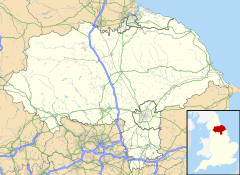
Ewe Cote is a small hamlet on the edge of the North York Moors National Park, set in the northern edge of the civil parish of Whitby, in North Yorkshire, England. According to the 2011 UK census, Ewe Cote has a population of 11.[1]
| Ewe Cote | |
|---|---|
 Ewe Cote | |
Location within North Yorkshire | |
| Population | 11 [1] |
| OS grid reference | NZ878107 |
| Civil parish |
|
| Unitary authority | |
| Ceremonial county | |
| Region | |
| Country | England |
| Sovereign state | United Kingdom |
| Post town | WHITBY |
| Postcode district | YO21 |
| Dialling code | 01947 |
| Police | North Yorkshire |
| Fire | North Yorkshire |
| Ambulance | Yorkshire |
| UK Parliament | |
Geography
editThe hamlet of Ewe Cote is situated within a small sheltered cirque drainage basin. The bedrock geology is Moor Grit Member (Quartz sandstone) and Glaciofluvial superficial Deposits (Sand and Gravel).[2] The Upgang Beck springs from the cirque and flows via the hamlet down through the Whitby Golf Course onto Upgang Beach.[3]
History
editEwe Cote Hall[4] and the Ewe Cote Hall garden walls,[5] as well as the farmhouse and the outbuildings, both cottages, and the garden wall of one cottage, are all Grade II* listed structures.
Notable residents
edit- Francis Meadow (Frank) Sutcliffe (1853-1941): was a pioneering photographer.[6] In the census of 1871, the Sutcliffe's are listed as living at Ewe Cote Hall and Frank is described as a photographer and artist's assistant. Today, Frank Sutcliffe's work is highly acclaimed for his pioneering black and white photographs of working people, bringing worldwide attention to Whitby.[7]
References
edit- ^ a b "Population 2011". Neighbourhood Statistics. doogal.co.uk. Retrieved 31 December 2021.
- ^ "Geological Survey of England and Wales 1:63,360/1:50,000 geological map series, New Series". largeimages.bgs.ac.uk. British Geological Survey. Retrieved 31 December 2021.
- ^ "ARCHI: Old Map of Ewe Cote North Yorkshire". archiuk.com. The Worldwide Archaeological and Historic Sites Index with Maps. Retrieved 31 December 2021.
- ^ Historic England. "Ewe Cote Hall Farmhouse (1316408)". National Heritage List for England. Retrieved 31 December 2021.
- ^ Historic England. "Ewe Cote Hall Garden Walls (1204632)". National Heritage List for England. Retrieved 1 January 2022.
- ^ Eglon Shaw, Bill (1995). Frank Meadow Sutcliffe Photographs Book Two. North Yorkshire: The Sutcliffe Gallery. ISBN 0-9503175-3-5.
- ^ "Frank Meadow Sutcliffe (1853-1941): the Whitby Photographer". thoresby.org.uk. The Thoresby Society. Retrieved 31 December 2021.
