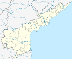
Dwaraka Tirumala mandal is one of the 28 mandals in Eluru district of the Indian state of Andhra Pradesh. It is under the administration of Eluru revenue division, and the headquarters are located at Dwaraka Tirumala.[2] The mandal is bounded by Jangareddygudem, Koyyalagudem, Kamavarapukota, Nallajerla, Pedavegi, Unguturu, Denduluru and Bhimadole mandals.[3]
Dwaraka Tirumala mandal | |
|---|---|
| Coordinates: 16°34′N 81°09′E / 16.57°N 81.15°E | |
| Country | India |
| State | Andhra Pradesh |
| District | Eluru |
| Headquarters | Dwaraka Tirumala |
| Government | |
| • Body | Mandal Parishad |
| Area | |
• Total | 250.35 km2 (96.66 sq mi) |
| Population (2011)[1] | |
• Total | 68,989 |
| • Density | 280/km2 (710/sq mi) |
| Languages | |
| • Official | Telugu |
| Time zone | UTC+5:30 (IST) |
Demographics
editAs of 2011[update] census, the mandal had a population of 68,989 with 19,180 households. The total population constitute, 34,797 males and 34,192 females —a sex ratio of 983 females per 1000 males. 7,260 children are in the age group of 0–6 years, of which 3,642 are boys and 3,618 are girls. The literacy rate stands at 61.41 with 42,364 literates.[1]
The mandal has the least urban area of 2.18 km2 (0.84 sq mi) and the least urban population of 5543 in Dwaraka Tirumala town of all the mandals in West Godavari district.[1]: 24
Government and politics
editDwaraka Tirumala mandal is one of the 4 mandals under Gopalapuram (SC) (Assembly constituency), which in turn represents Rajahmundry (Lok Sabha constituency) of Andhra Pradesh.[4]
Towns and villages
editAs of 2011[update] census of India, the mandal has 35 settlements, which includes 1 towns and 34 villages. Dwaraka tirumala (C.T.) is the only town.[2][1]
The settlements in the mandal are listed below:
- Chelikanivanipothepalle
- Dadavalli
- Dorasanipadu
- Dwaraka Tirumala (CT) †
- G.Kothapalle
- Gollavadi Kunta
- Gopikunta Khandrika
- Gundugolanukunta
- Gunnampalle
- Havelilingapalem
- I.S.Jagannadhapuram
- I.S.Raghavapuram
- Jajulakunta
- Khandrika
- Kodigudem
- Kommara (North)
- Kommara (South)
- Kommugudem
- Krishnapuram
- Lingaraopalem
- M.Nagulapalle
- Malasanikunta
- Malleswaram
- Narayanapuram
- P.Kannapuram
- Pangidigudem
- Rallakunta
- Ramannagudem
- Sarabhapuram
- Sathenagudem
- Sattala
- Takkellapadu
- Thimmapuram
- Tirumalampalem
- Vempadu
- Venkatakrishnapuram
- Notes
- (CT) denotes a Census town[5]
- (†) Mandal headquarter
References
edit- ^ a b c d e "District Census Handbook - West Godavari" (PDF). Census of India. pp. 22, 212. Retrieved 18 February 2016.
- ^ a b "West Godavari District Mandals" (PDF). Census of India. p. 428. Retrieved 18 February 2016.
- ^ "Mandals in West Godavari district". aponline.gov.in. Archived from the original on 29 April 2015. Retrieved 18 February 2016.
- ^ "Delimitation of Parliamentary and Assembly Constituencies Order, 2008" (PDF). Election Commission of India. p. 20,30. Retrieved 18 February 2016.
- ^ "Abbreviations used". censusindia.gov.in. Retrieved 26 May 2014.

