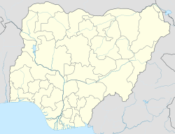
Dekina is a local government area in Kogi State, Nigeria. Its headquarters are in the town of Dekina, on the A233 highway in the Middle Belt area at 7°41′41″N 7°01′20″E / 7.69472°N 7.02222°E.
Dekina
Ajobi | |
|---|---|
LGA and town | |
 Dekina in 1969 | |
| Motto: Unity is strength | |
| Coordinates: 7°35′N 7°12′E / 7.583°N 7.200°E | |
| Country | Nigeria |
| State | Kogi State |
| Area | |
| • Total | 2,461 km2 (950 sq mi) |
| Population (2006 census) | |
| • Total | 260,312 |
| Time zone | UTC+1 (WAT) |
| 3-digit postal code prefix | 272 |
| ISO 3166 code | NG.KO.DE |
 | |
The northeasterly line of equal latitude and longitude passes through the southeast of the LGA.
It has an area of 2,461 km2 (950 sq mi) and a population of 260,312 at the 2006 census.[1]
The postal code of the area is 272.[2]
Climatic Condition
editWith a year-round temperature range of 64°F to 93°F and a wet season marked by overcast skies and a dry season marked by humid skies, the climate is hot and oppressive.[3][4]
References
edit- ^ HASC, population, area and Headquarters Statoids
- ^ "Post Offices- with map of LGA". NIPOST. Retrieved 2009-10-20.[permanent dead link]
- ^ "Dekina Climate, Weather By Month, Average Temperature (Nigeria) - Weather Spark". weatherspark.com. Retrieved 2023-09-10.
- ^ "Dekina, Kogi, NG Climate Zone, Monthly Averages, Historical Weather Data". tcktcktck.org. Retrieved 2023-09-10.
Further reading
edit- Falola, Toyin (25 September 2009). "Colonialism and Violence in Nigeria". Indiana University Press. p. 103 – via Google Books.
