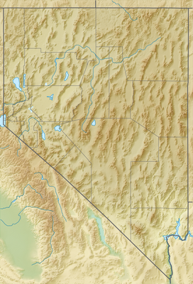
Daggett Pass is a road mountain pass located in the Carson Range, a spur of the Sierra Nevada. It sits at an elevation of 7,343 ft (2,238 m) in Douglas County, Nevada, on the border between the Lake Tahoe Basin Management Unit to the west and the Humboldt-Toiyabe National Forest to the east. The mountain pass is traversed by State Route 207 and is frequently referred to as Kingsbury Grade.[3]
| Daggett Pass | |
|---|---|
Douglas County, Nevada, United States | |
| Highest point | |
| Elevation | 7,343 ft (2,238 m)[1] |
| Coordinates | 38°58′36″N 119°53′20″W / 38.97667°N 119.88889°W[1][2] |
| Geography | |
| Location | Douglas County, Nevada, United States |
| Parent range | Sierra Nevada |
Climate
edit| Climate data for Daggett Pass, Nevada, 1991–2020 normals: 7334ft (2235m) | |||||||||||||
|---|---|---|---|---|---|---|---|---|---|---|---|---|---|
| Month | Jan | Feb | Mar | Apr | May | Jun | Jul | Aug | Sep | Oct | Nov | Dec | Year |
| Mean daily maximum °F (°C) | 35.7 (2.1) |
36.8 (2.7) |
41.7 (5.4) |
47.8 (8.8) |
56.1 (13.4) |
66.5 (19.2) |
74.6 (23.7) |
73.5 (23.1) |
67.1 (19.5) |
55.2 (12.9) |
43.3 (6.3) |
34.8 (1.6) |
52.8 (11.6) |
| Daily mean °F (°C) | 29.4 (−1.4) |
30.0 (−1.1) |
33.7 (0.9) |
38.3 (3.5) |
45.6 (7.6) |
54.5 (12.5) |
62.0 (16.7) |
61.2 (16.2) |
55.3 (12.9) |
45.3 (7.4) |
35.7 (2.1) |
28.6 (−1.9) |
43.3 (6.3) |
| Mean daily minimum °F (°C) | 23.1 (−4.9) |
23.2 (−4.9) |
25.7 (−3.5) |
28.8 (−1.8) |
35.1 (1.7) |
42.4 (5.8) |
49.3 (9.6) |
49.0 (9.4) |
43.6 (6.4) |
35.5 (1.9) |
28.1 (−2.2) |
22.5 (−5.3) |
33.9 (1.0) |
| Average precipitation inches (mm) | 3.78 (96) |
3.45 (88) |
2.81 (71) |
1.25 (32) |
1.10 (28) |
0.60 (15) |
0.17 (4.3) |
0.40 (10) |
0.32 (8.1) |
1.22 (31) |
1.79 (45) |
3.31 (84) |
20.2 (512.4) |
| Average snowfall inches (cm) | 26.3 (67) |
25.9 (66) |
19.7 (50) |
6.2 (16) |
1.3 (3.3) |
0.4 (1.0) |
0.0 (0.0) |
0.0 (0.0) |
trace | 1.9 (4.8) |
10.7 (27) |
31.0 (79) |
123.4 (314.1) |
| Source 1: NOAA[4] | |||||||||||||
| Source 2: XMACIS2 (Snowfall)[5] | |||||||||||||
See also
editReferences
edit- ^ a b "Daggett Pass". Geographic Names Information System. United States Geological Survey, United States Department of the Interior. Retrieved January 31, 2023.
- ^ United States Geological Survey. South Lake Tahoe, California (Topographic map). 1:24,000. 7.5 minute series. Reston, VA: United States Geological Survey. Retrieved May 10, 2018 – via TopoQuest.
- ^ Kingsbury and Zephyr Cove Area (PDF) (Map). Nevada Department of Transportation. 2007. Retrieved 30 May 2011.
- ^ "Daggett Pass, Nevada 1991-2020 Monthly Normals". National Oceanic and Atmospheric Administration. Retrieved October 8, 2023.
- ^ "xmACIS". National Oceanic and Atmospheric Administration. Retrieved November 9, 2023.
