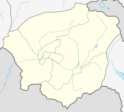
39°46′02″N 45°08′27″E / 39.76722°N 45.14083°E
Chiva
Չիվա | |
|---|---|
 | |
| Coordinates: 39°46′02″N 45°08′27″E / 39.76722°N 45.14083°E | |
| Country | Armenia |
| Province | Vayots Dzor |
| Municipality | Areni |
| Population | |
• Total | 698 |
| Time zone | UTC+4 (AMT) |
| Chiva, Armenia at GEOnet Names Server | |
Chiva (Armenian: Չիվա) is a village in the Areni Municipality of the Vayots Dzor Province in Armenia,[2] 20 km west of the Province center, on the right and left banks of the Yelpin River.
Etymology
editThe village is also known as Chivagyugh.
Population
editAccording to the RA 2011 census results, Chiva had a recorded permanent population of 361 individuals, with a current population of 651.[1]
The population dynamics of Chiva over the years:[3]
| Year | 1831 | 1873 | 1897 | 1926 | 1939 | 1959 | 1970 | 1979 | 1989 | 2001 | 2011 |
|---|---|---|---|---|---|---|---|---|---|---|---|
| Population | 52 | 294[4] | 689 | 461 | 758 | 669 | 910 | 933 | 755 | 892 | 698[1] |
Occupation
editThe population is engaged in viticulture, cultivation of grain, tobacco, and vegetable crops.
Historical and cultural sites
editThere is a 10th-century church in the village.[3]
References
edit- ^ a b c Statistical Committee of Armenia. "The results of the 2011 Population Census of Armenia" (PDF).
- ^ "RA Vayots Dzor Marz" (PDF). Marzes of the Republic of Armenia in Figures. 2009. pp. 264–270. Retrieved 27 June 2023.
- ^ a b "Centre of Geodesy and Cartography" SNCO under Cadastre Committee of the Republic of Armenia (2008). Dictionary of settlements of the Republic of Armenia (PDF). Yerevan. p. 184. Archived from the original (PDF) on 9 February 2020.
{{cite book}}: CS1 maint: location missing publisher (link) - ^ Zaven Korkotyan (1932). The population of Soviet Armenia in the last century (1831–1931) (PDF). Yerevan: Publication of the Melkonian Fund.
External links
editWikimedia Commons has media related to Chiva, Armenia.

