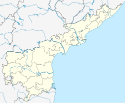
Chirala mandal is one of the 25 mandals in Bapatla district of the Indian state of Andhra Pradesh. It is administered under Chirala revenue division and its headquarters are located at Chirala. The mandal is situated at the shore of Bay of Bengal and is bounded by Parchur, Karamchedu and Vetapalem mandals.[1][2]
Chirala mandal | |
|---|---|
| Coordinates: 15°49′29″N 80°21′08″E / 15.8246°N 80.3521°E | |
| Country | India |
| State | Andhra Pradesh |
| District | Bapatla |
| Headquarters | Chirala |
| Languages | |
| • Official | Telugu |
| Time zone | UTC+5:30 (IST) |
Towns and villages
editAs of 2011[update] census, the mandal has 5 settlements. It includes 2 towns and 3 villages. Chirala is the municipality and its adjoining area was classified as a census town with the same name.[3][1]
- Chirala (CT)
- Chirala (M)
- Gavinivaripalem
- Ipurupalem (part)
- Vodarevu
Note:[4] M: Municipality, CT: Census town, OG: Out Growth
See also
editReferences
edit- ^ a b "Guntur District Mandals" (PDF). Census of India. pp. 141, 175. Retrieved 19 January 2015.
- ^ "Mandals in Prakasam district". aponline.gov.in. Archived from the original on 6 June 2014. Retrieved 10 September 2014.
- ^ "Sub-District Details of Guntur District". The Registrar General & Census Commissioner, India. Retrieved 24 May 2014.
- ^ "Abbreviations used". censusindia.gov.in. Archived from the original on 17 June 2007. Retrieved 26 May 2014.

