Cerhenice is a market town in Kolín District in the Central Bohemian Region of the Czech Republic. It has about 1,900 inhabitants.
Cerhenice | |
|---|---|
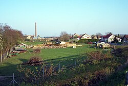
 View of Cerhenice | |
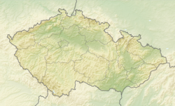
| Coordinates: 50°4′17″N 15°4′20″E / 50.07139°N 15.07222°E | |
| Country | |
| Region | Central Bohemian |
| District | Kolín |
| First mentioned | 1295 |
| Area | |
• Total | 10.64 km2 (4.11 sq mi) |
| Elevation | 209 m (686 ft) |
| Population (2024-01-01)[1] | |
• Total | 1,908 |
| • Density | 180/km2 (460/sq mi) |
| Time zone | UTC+1 (CET) |
| • Summer (DST) | UTC+2 (CEST) |
| Postal codes | 280 02, 281 02 |
| Website | www |
Administrative parts
editThe village of Cerhýnky is an administrative part of Cerhenice.
Etymology
editThe initial name of the village was Crhynice, meaning "the village of Crhyň's people".[2]
Geography
editCerhenice is located about 10 kilometres (6 mi) northwest of Kolín and 38 km (24 mi) east of Prague. It lies in a flat agricultural landscape of the Central Elbe Table.
History
editThe first written mention of Cerhenice is from 1295. For centuries, it was owned by various lower noblemen. Around 1520, during the rule of Eliška of Střížkov, the village was promoted to a market town. For the longest time, Cerhenice was owned by the Střela of Rokyce family (1550–1689). The most notable owners were the Sternberg family, who inherited Cerhenice in 1689, and the Kolowrat family, who bought it from the Sternbergs in 1757.[2]
Demographics
edit
|
|
| ||||||||||||||||||||||||||||||||||||||||||||||||||||||
| Source: Censuses[3][4] | ||||||||||||||||||||||||||||||||||||||||||||||||||||||||
Economy
editPart of the Velim railway test circuit is located in the territory of Cerhenice.
Transport
editCerhenice is located on the railway line Prague–Kolín.[5]
Sights
editThe Church of Saint John of Nepomuk was built in the Baroque style in 1734, by Countess Leopoldina of Sternberg. She also had built the statue of Our Lady of Sorrows from 1745, located in the middle of the town square.[2][6]
The Gothic fortress in Cerhenice was built in 1340. In 1618, it was rebuilt in the Renaissance style. The fortress was looted by rebellious peasants in 1775 and three years later, the administration was moved to the newly built castle in the neighborhood. In modern times, the building was converted into apartments.[7]
The Cerhenice Castle was built on the site of the farm buildings of the old fortress in 1770–1771. It was built by the Institute of Nobles in Prague and never served as the residence of the nobility. It is a one-story baroque building. Today it is privately owned.[8]
Notable people
edit- Blanka Waleská (1910–1986), actress
References
edit- ^ "Population of Municipalities – 1 January 2024". Czech Statistical Office. 2024-05-17.
- ^ a b c "Historie: První zpráva o Cerhenicích" (in Czech). Obec Cerhenice. Retrieved 2023-01-02.
- ^ "Historický lexikon obcí České republiky 1869–2011" (in Czech). Czech Statistical Office. 2015-12-21.
- ^ "Population Census 2021: Population by sex". Public Database. Czech Statistical Office. 2021-03-27.
- ^ "Detail stanice Cerhenice" (in Czech). České dráhy. Retrieved 2024-05-28.
- ^ "Kostel sv. Jana Nepomuckého" (in Czech). National Heritage Institute. Retrieved 2023-01-02.
- ^ "Cerhenice: tvrz". Cesty a památky (in Czech). Retrieved 2023-01-02.
- ^ "Cerhenice: zámek". Cesty a památky (in Czech). Retrieved 2023-01-02.
External links
edit


