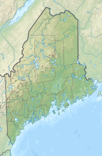
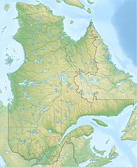
Caribou Mountain is a mountain on the Canada–United States border, the section of which follows the height of land of the Saint Lawrence River watershed.[2] The peak is located about 0.5 mi (0.80 km) inside Franklin County, Maine. The southwest end of Caribou's summit ridge is in Le Granit Regional County Municipality, Québec.
| Caribou Mountain | |
|---|---|
 | |
| Highest point | |
| Elevation | 3,650 ft (1,110 m)[1] |
| Prominence | 1,230 ft (370 m)[1] |
| Listing | New England Fifty Finest #26 |
| Coordinates | 45°25′47″N 70°37′23″W / 45.42974°N 70.62306°W[2] |
| Geography | |
| Location | Franklin County, Maine, U.S. |
| Topo map | USGS Kibby Mountain |
The northwest side of Caribou Mountain drains into the West Branch of the Moose River, thence into the South Branch of the Moose, the Moose River, and the Kennebec River, then into the Gulf of Maine. The southeast side of Caribou Mountain drains into Number Six Brook, then into the South Branch of the Moose River. The southwest end of Caribou Mountain drains into Rivière aux Araignées in Saint-Augustin-de-Woburn, Quebec, then into Lac aux Araignées, Lac Mégantic, the Rivière Chaudière, the Saint Lawrence River, and into the Gulf of Saint Lawrence.
Climate
edit| Climate data for Caribou Mountain 45.4339 N, 70.6157 W, Elevation: 3,327 ft (1,014 m) (1991–2020 normals) | |||||||||||||
|---|---|---|---|---|---|---|---|---|---|---|---|---|---|
| Month | Jan | Feb | Mar | Apr | May | Jun | Jul | Aug | Sep | Oct | Nov | Dec | Year |
| Mean daily maximum °F (°C) | 14.7 (−9.6) |
16.8 (−8.4) |
25.7 (−3.5) |
40.6 (4.8) |
54.8 (12.7) |
64.1 (17.8) |
68.6 (20.3) |
66.8 (19.3) |
60.0 (15.6) |
46.7 (8.2) |
32.2 (0.1) |
20.8 (−6.2) |
42.7 (5.9) |
| Daily mean °F (°C) | 7.2 (−13.8) |
9.1 (−12.7) |
18.7 (−7.4) |
32.2 (0.1) |
46.5 (8.1) |
56.0 (13.3) |
60.6 (15.9) |
58.9 (14.9) |
51.5 (10.8) |
38.1 (3.4) |
26.3 (−3.2) |
12.4 (−10.9) |
34.8 (1.5) |
| Mean daily minimum °F (°C) | −0.2 (−17.9) |
1.5 (−16.9) |
11.6 (−11.3) |
23.9 (−4.5) |
38.3 (3.5) |
47.9 (8.8) |
52.6 (11.4) |
50.9 (10.5) |
42.9 (6.1) |
29.5 (−1.4) |
20.4 (−6.4) |
4.0 (−15.6) |
26.9 (−2.8) |
| Average precipitation inches (mm) | 4.47 (114) |
4.04 (103) |
4.24 (108) |
4.89 (124) |
4.79 (122) |
6.55 (166) |
5.70 (145) |
5.16 (131) |
4.43 (113) |
7.35 (187) |
4.32 (110) |
5.36 (136) |
61.3 (1,559) |
| Source: PRISM Climate Group[3] | |||||||||||||
See also
editReferences
edit- ^ a b "Caribou Mountain, Maine". Peakbagger.com. Retrieved 2023-03-16.
- ^ a b "Caribou Mountain". Geographic Names Information System. United States Geological Survey, United States Department of the Interior. Retrieved 2013-01-29.
- ^ "PRISM Climate Group, Oregon State University". PRISM Climate Group, Oregon State University. Retrieved October 24, 2023.
To find the table data on the PRISM website, start by clicking Coordinates (under Location); copy Latitude and Longitude figures from top of table; click Zoom to location; click Precipitation, Minimum temp, Mean temp, Maximum temp; click 30-year normals, 1991-2020; click 800m; click Retrieve Time Series button.

