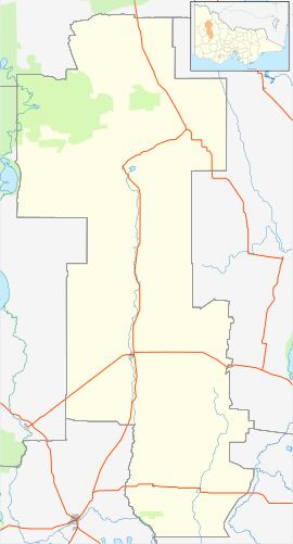
Beulah is a town in the southern Mallee region of Victoria, Australia. The town is in the Shire of Yarriambiack local government area, 395 kilometres north-west of the state capital, Melbourne. At the 2016 census, Beulah had a population of 329.[1]
| Beulah Victoria | |||||||||
|---|---|---|---|---|---|---|---|---|---|
 Main street of Beulah, 2012 | |||||||||
| Coordinates | 35°56′17″S 142°25′12″E / 35.93806°S 142.42000°E | ||||||||
| Population | 329 (2016 census)[1] | ||||||||
| Postcode(s) | 3395 | ||||||||
| Elevation | 100 m (328 ft) | ||||||||
| Location |
| ||||||||
| LGA(s) | Shire of Yarriambiack | ||||||||
| State electorate(s) | Mildura | ||||||||
| Federal division(s) | Mallee | ||||||||
| |||||||||
History
editThe town's name is taken from the Book of Isaiah, 62:4. In some English translations, the word is given as "married" or "inhabited".[2]
Beulah was established on land that was once part of Brim station. Closer settlement began in the 1880s and the town site was proclaimed in 1891. A post office opened on May 6, 1891, and the railway from Warracknabeal opened on 5 January 1893.[3][4] The line to Hopetoun opened on 6 March 1894.[4] The town claims to be the closest to the rabbit-proof fence, established in the first decade of the 20th century to prevent the incursion of rabbit plagues.[5]
Beulah was the location for the fictional town Kiewarra in the 2019 film The Dry, starring Eric Bana.[6]
Climate
edit| Climate data for Beulah, elevation 89 m (292 ft) | |||||||||||||
|---|---|---|---|---|---|---|---|---|---|---|---|---|---|
| Month | Jan | Feb | Mar | Apr | May | Jun | Jul | Aug | Sep | Oct | Nov | Dec | Year |
| Record high °C (°F) | 46.7 (116.1) |
44.3 (111.7) |
40.4 (104.7) |
35.0 (95.0) |
27.8 (82.0) |
24.4 (75.9) |
26.5 (79.7) |
27.7 (81.9) |
34.2 (93.6) |
38.3 (100.9) |
42.2 (108.0) |
44.0 (111.2) |
46.7 (116.1) |
| Mean daily maximum °C (°F) | 30.9 (87.6) |
30.4 (86.7) |
27.2 (81.0) |
22.2 (72.0) |
17.6 (63.7) |
14.5 (58.1) |
13.9 (57.0) |
15.6 (60.1) |
18.6 (65.5) |
22.3 (72.1) |
26.1 (79.0) |
29.0 (84.2) |
22.4 (72.3) |
| Mean daily minimum °C (°F) | 13.7 (56.7) |
13.9 (57.0) |
11.7 (53.1) |
8.7 (47.7) |
6.3 (43.3) |
4.3 (39.7) |
3.6 (38.5) |
4.2 (39.6) |
5.6 (42.1) |
7.5 (45.5) |
9.9 (49.8) |
12.2 (54.0) |
8.5 (47.3) |
| Record low °C (°F) | 4.0 (39.2) |
6.7 (44.1) |
3.9 (39.0) |
1.1 (34.0) |
−2.1 (28.2) |
−3.9 (25.0) |
−3.2 (26.2) |
−2.8 (27.0) |
−0.9 (30.4) |
−1.7 (28.9) |
1.9 (35.4) |
3.9 (39.0) |
−3.9 (25.0) |
| Average rainfall mm (inches) | 22.5 (0.89) |
24.5 (0.96) |
21.2 (0.83) |
25.0 (0.98) |
38.1 (1.50) |
37.5 (1.48) |
36.0 (1.42) |
39.0 (1.54) |
37.6 (1.48) |
35.4 (1.39) |
28.9 (1.14) |
25.7 (1.01) |
371.2 (14.61) |
| Average rainy days (≥ 1.0 mm) | 2.4 | 2.3 | 2.7 | 3.9 | 5.8 | 6.6 | 7.6 | 7.7 | 6.7 | 5.6 | 4.1 | 3.3 | 58.7 |
| Source: Australian Bureau of Meteorology[7] | |||||||||||||
References
edit- ^ a b Australian Bureau of Statistics (27 June 2017). "Beulah (State Suburb)". 2016 Census QuickStats. Retrieved 4 October 2018.
- ^ "Beulah". Travel. Sydney Morning Herald. 8 February 2004. Retrieved 28 May 2007.
- ^ Phoenix Auctions History. "Post Office List". Retrieved 28 January 2021.
- ^ a b "Hopteoun Line". Infrastructure. VICSIG. 2012. Retrieved 30 November 2012.
- ^ "Beulah, Victoria". Travelmate. Retrieved 27 May 2007.
- ^ "Drought, no pub and a burnt-down general store: Struggling town of 300 shines in major movie role". ABC News. 16 January 2021. Retrieved 13 September 2024.
- ^ "Climate statistics for Australian locations- BEULAH". 8 July 2024.
External links
editMedia related to Beulah, Victoria at Wikimedia Commons
- Official town website
- Yarriambiack Shire Council - Official council site
