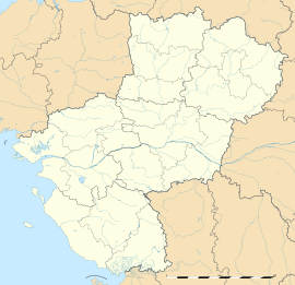
Benet (French pronunciation: [bənɛ]) is a commune in the Vendée department in the Pays de la Loire region in western France.
Benet | |
|---|---|
 The Church of Sainte-Eulalie, in Benet | |
| Coordinates: 46°22′06″N 0°35′46″W / 46.3683°N 0.5961°W | |
| Country | France |
| Region | Pays de la Loire |
| Department | Vendée |
| Arrondissement | Fontenay-le-Comte |
| Canton | Fontenay-le-Comte |
| Government | |
| • Mayor (2023–2026) | Camille Fontaine[1] |
| Area 1 | 50.01 km2 (19.31 sq mi) |
| Population (2021)[2] | 4,059 |
| • Density | 81/km2 (210/sq mi) |
| Time zone | UTC+01:00 (CET) |
| • Summer (DST) | UTC+02:00 (CEST) |
| INSEE/Postal code | 85020 /85490 |
| Elevation | 44 m (144 ft) |
| 1 French Land Register data, which excludes lakes, ponds, glaciers > 1 km2 (0.386 sq mi or 247 acres) and river estuaries. | |
The former communes of Lesson, Sainte-Christine and Aziré were joined to the commune of Benet in 1973.
Geography
editClose to Niort (11 kilometres or 7 miles) in Deux-Sèvres and Fontenay-le-Comte (19 km or 12 mi) in Vendée, Benet is located near :
- South-Vendée
- Poitevin Marsh
- Atlantic Coast
The diversity of the landscapes, the limestone plain, along with the marshes of Sainte-Christine, Aziré and Nessier, make this commune a varied place, rich of its differences.
The Vrizon is the underground river that goes through the commune.
Benet is located close to the A83 and A10 motorways, connecting the commune to some major cities, as Nantes (130 km or 81 mi), Poitiers (98 km or 61 mi), Bordeaux (193 km or 120 mi), or Paris (428 km or 266 mi). Benet is also situated 64 km (40 mi) from the tourist city of La Rochelle.
History
edit- Benet was formerly named Benet-les-Noyers.
- Former seat of a canton until 1801–1802, Benet has ultimately integrated the Canton of Maillezais.
- The communes of Lesson, Aziré and Sainte-Christine merged with the commune of Benet in 1973.
List of mayors
edit| Period | Identity | Party |
|---|---|---|
| 2001 - 2023 | Daniel David | Socialist Party |
| 2023 - | Camille Fontaine |
Demography
edit| Year | Pop. | ±% p.a. |
|---|---|---|
| 1968 | 2,583 | — |
| 1975 | 2,761 | +0.96% |
| 1982 | 3,062 | +1.49% |
| 1990 | 3,224 | +0.65% |
| 1999 | 3,202 | −0.08% |
| 2007 | 3,565 | +1.35% |
| 2012 | 3,853 | +1.57% |
| 2017 | 4,011 | +0.81% |
| Source: INSEE[3] | ||
Monuments
editThe Sainte-Eulalie Church, on the historical register, constitutes an unmissable stage in the tour of the Romance Churches and Abbeys of the region.
A few kilometres away, it is possible to visit the historic site of the Maillezais Cathedral.
A wind farm was created near Lesson in 2007, and several months later, a second was established 3 km (2 mi) away from the first. A total of ten wind turbines overhang the commune.
Notable people
edit- Jean-Paul Ribreau (born 1957), former professional footballer
Twin towns
editEvents
edit- Each first Sunday of July, the "Fête du Préfou" is organized in the harbor of Aziré.
- In November, is organized the traditional "Foire aux alouettes" (Lark Fair).
See also
editReferences
edit- ^ "Répertoire national des élus: les maires" (in French). data.gouv.fr, Plateforme ouverte des données publiques françaises. 30 November 2023.
- ^ "Populations légales 2021" (in French). The National Institute of Statistics and Economic Studies. 28 December 2023.
- ^ Population en historique depuis 1968, INSEE
External links
edit


