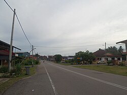
Bekok is a mukim in Segamat District, Johor, Malaysia. It is the western entrance to Endau Rompin National Park and has a waterfall known as Sungai Bantang Waterfall. Bekok also houses several aborigine settlements (Perkampungan Orang Asli), such as Kampung Kudong and Kampung Kemidak.
Bekok 彼咯 | |
|---|---|
 | |
 | |
| Country | Malaysia |
| State | Johor |
| District | Segamat |
| Area | |
| • Total | 785 km2 (303 sq mi) |
During the pre-independence period, this small town was a "Black Area" known for strong communist resistance against the British government.
Name
editThe town's name probably originally arrived from the Hakka dialect word "Mukok", which means "the corner", where the town is in fact a remote town located roughly about 10 km from the junction of the Federal Route 1 and later accessible via railway.
Geology
editAt an area of 785 km2, it is the largest mukim in Segamat District.[1]
History
editThe earliest Malay settlement set by the Penghulu (Village Head) was located near the bridge of the Bekok River on the way to Sg. Bantang waterfall, at a junction to Sg. Bekok Estate. It's said the first Penghulu was Sulaiman Bin Ain. He was then succeeded by his son Alam Bin Sulaiman. The name Bekok was said to be taken from the local fauna found called "Burung Punai Bakok" when he first opened the area. There was once a Penghulu house near the junction of Sg. Bekok Estate with inscription on the concrete apron written "1926" at the entrance. Penghulu Alam died on 14 August 1969 at the age of 89 years. He was then succeeded by his son Ismail Bin Alam. After the demise of Penghulu Ismail on 18 September 2000, the tradition of Penghulu from the same family has been stopped. Now the Penghulu is a position open to all eligible candidate under the Local Johor Government.
Demographics
editThe following is based on Department of Statistics Malaysia 2010 census.[2]
| Ethnic groups in Bekok, 2010 | ||
|---|---|---|
| Ethnicity | Population | Percentage |
| Bumiputera, Malay | 320 | 19.23% |
| Chinese | 1,151 | 69.17% |
| Indian | 115 | 6.91% |
| Other Bumiputera | 9 | 0.54% |
| Others | 7 | 0.42% |
| Non-Malaysian | 62 | 3.73% |
Education
editPrimary school
edit- Sekolah Kebangsaan Seri Bekok
- Sekolah Kebangsaan Kampong Kudung
- Sekolah Jenis Kebangsaan (Tamil) Bekok
- Sekolah Jenis Kebangsaan (Cina) Bekok
Secondary school
edit- Sekolah Menengah Kebangsaan Bekok
Tourist attractions
editTransportation
editBekok is accessible via road, specifically State Route J150 which connects Chaah and Bekok to Paloh in Kluang District. Its first junction is located about 4 km from Chaah via Federal Route 1. Bekok is located 10 km from the junction and 18 km from Paloh.[3]
Bekok is also accessible by train via the Bekok railway station.
See also
editReferences
edit- ^ "Archived copy" (PDF). Archived from the original (PDF) on 2016-08-18. Retrieved 2016-07-28.
{{cite web}}: CS1 maint: archived copy as title (link) - ^ "Population Distribution by Local Authority Areas and Mukims, 2010" (PDF). Department of Statistics Malaysia. Archived from the original (PDF) on 27 February 2012.
- ^ "Discover the Hidden Gem of Bekok Town - TheGuyTravel".