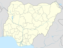
Batsari is a Local Government Area in Katsina State, Nigeria. Its headquarters is located in the town of Batsari.
Batsari | |
|---|---|
LGA and town | |
| Coordinates: 12°45′10″N 7°14′31″E / 12.75278°N 7.24194°E | |
| Country | |
| State | Katsina State |
| Established | 1989 [1] |
| Government | |
| • Chairman | Lawal Musa (Aganku) |
| Area | |
• Total | 1,107 km2 (427 sq mi) |
| Population (2006 census) | |
• Total | 208,978 |
| Time zone | UTC+1 (WAT) |
| 3-digit postal code prefix | 820 |
| ISO 3166 code | NG.KT.BTR |
 | |
It has an area of 1,107 km2 and a population of 208,978 at the 2006 census.
The postal code of the area is 820.[1]
Climatic Condition
editIntense wet season with mostly cloudy skies, dry season with partly cloudy skies, and fluctuating temperatures are all year round in Batsari.[2][3]
Average Temperature
editWith an average daily high temperature of 98°F, the hot season spans 2.3 months, from March 17 to May 27. April is the hottest month of the year in Batsari, with an average high temperature of 101°F and low temperature of 76°F. With an average daily maximum temperature below 87°F, the cool season spans 1.6 months, from December 9 to January 29. January is the coolest month of the year in Batsari, with typical highs of 85°F and lows of 59°F.[2]
References
edit- ^ "Post Offices- with map of LGA". NIPOST. Archived from the original on 7 October 2009. Retrieved 2009-10-20.
- ^ a b "Batsari Climate, Weather By Month, Average Temperature (Nigeria) - Weather Spark". weatherspark.com. Retrieved 2023-08-29.
- ^ "Batsari, Katsina, NG Climate Zone, Monthly Averages, Historical Weather Data". tcktcktck.org. Retrieved 2023-08-29.
