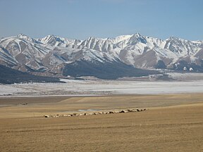
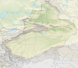
The Barkol Tagh, also known as Barkol Shan (Chinese: 巴里坤山), forms together with the Qarlik Tagh the easternmost end of the Tian Shan mountain range. It is located along an active thrust fault in the Kumul prefecture in Xinjiang province.[1]
| Barkol Tagh | |
|---|---|
 Northeastern flank of the Barkol range | |
| Geography | |
| State(s) | Xinjiang |
| Range coordinates | 43°24′44″N 93°18′58″E / 43.412194071790125°N 93.31597945910963°E |
| Parent range | Tian Shan |
Barkol city and the hypersaline Lake Balikun (116 km2) are located at the northern flank of the mountain range. There, mean annual temperature is 1.0°C and mean annual precipitation is 210 mm.[2][3]
Another branch of the Tian Shan, the Meiqinwula Mountains, is located north of the Lake Balikun basin.
References
edit- ^ Cunningham, Dickson; Owen, Lewis A.; Snee, Larry W.; Li, Jiliang (2003). "Structural framework of a major intracontinental orogenic termination zone: The easternmost Tien Shan, China". Journal of the Geological Society. 160 (4): 575–590. Bibcode:2003JGSoc.160..575C. doi:10.1144/0016-764902-122. S2CID 44703162.
- ^ Zhao, Yongtao; An, Cheng-Bang; Mao, Limi; Zhao, Jiaju; Tang, Lingyu; Zhou, Aifeng; Li, Hu; Dong, Weimiao; Duan, Futao; Chen, Fahu (2015-10-15). "Vegetation and climate history in arid western China during MIS2: New insights from pollen and grain-size data of the Balikun Lake, eastern Tien Shan". Quaternary Science Reviews. 126: 112–125. Bibcode:2015QSRv..126..112Z. doi:10.1016/j.quascirev.2015.08.027.
- ^ An, Cheng-Ban; Lu, Yanbin; Zhao, Jiaju; Tao, Shichen (2012). "A high-resolution record of Holocene environmental and climatic changes from Lake Balikun (Xinjiang, China): Implications for central Asia". The Holocene. 22 (1): 43–52. Bibcode:2012Holoc..22...43A. doi:10.1177/0959683611405244. S2CID 131477257.
