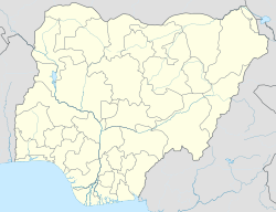
Bakori, is a local government area in Katsina State, Nigeria. It was created on 15 May 1989 by the then military governor of Katsina State Major General Lawrence Onoja.
Bakori | |
|---|---|
LGA and town | |
| Coordinates: 11°33′N 7°26′E / 11.550°N 7.433°E | |
| Country | |
| State | Katsina State |
| Established | 1989 |
| Government | |
| • Type | Local Government |
| Area | |
• Total | 679 km2 (262 sq mi) |
| Population (2006 census) | |
• Total | 641,576 |
| Time zone | UTC+1 (WAT) |
| 3-digit postal code prefix | 831 |
| ISO 3166 code | NG.KT.BK |
 | |
It has an area of 679 km2 and a population of 641,576 as of the 2006 census. It shares border with Funtua by the west, Malumfashi in the north, Danja in the south and Kankara in the east. Federal Government Girls College is located at Bakori.[1]
The postal code of the area is 831.[2]
Geography
editBakori local government area covers a total land area of 679 square kilometres with wind speed of 4 km/h. The area has an average temperature of 36 °C, while the humidity of the area is recorded at 14%.[1]
Climate
editYearly temperature in Bakori varies between rainy season and dry season, with oppressive cloudy conditions and hot temperatures.[3][4]
Climate change is causing a warmer, colder climate in Bakori, as evidenced by the positive trend of temperature increases and warming stripes.[5]
Average Temperature
editWith an average daily high temperature of 94°F, the hot season spans 1.9 months, from March 9 to May 4. At an average high temperature of 96°F and low temperature of 71°F, April is Bakori's hottest month of the year. With an average daily maximum temperature below 85°F, the cool season spans 2.8 months, from July 7 to October 1. January is the coldest month of the year in Bakori, with an average high temperature of 85°F and low temperature of 55°F.[3]
Notable people
editNotable people from Bakori include:
- Amina Lawal - sentenced to death by stoning for adultery, but eventually acquitted
- Senator Mohammed Tukur Liman - former Senate Majority Leader (1999-2003)
References
edit- ^ a b "Bakori Local Government Area". www.manpower.com.ng. Retrieved 2021-07-12.
- ^ "Post Offices- with map of LGA". NIPOST. Archived from the original on 7 October 2009. Retrieved 2009-10-20.
- ^ a b "Bakori Climate, Weather By Month, Average Temperature (Nigeria) - Weather Spark". weatherspark.com. Retrieved 2023-08-28.
- ^ "Bakori, Katsina, NG Climate Zone, Monthly Averages, Historical Weather Data". tcktcktck.org. Retrieved 2023-08-28.
- ^ "Climate Change Bakori". meteoblue. Retrieved 2023-10-21.
External links
edit
