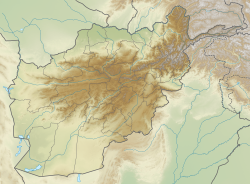
Baghlan (Pashto and Dari: بغلان Baġlān) is a city in northern Afghanistan, in the eponymous province, Baghlan Province. It is located three miles east of the Kunduz River, 35 miles south of Khanabad, and about 500 metres above sea level in the northern Hindu Kush. Baghlan's capital, Pul-e-Khumri, is known to be an economic hub connected to eight other provinces by the Kabul-North highway.[1]
Baghlan
بغلان | |
|---|---|
| Coordinates: 36°7′58″N 68°42′0″E / 36.13278°N 68.70000°E | |
| Country | |
| Province | Baghlan Province |
| Elevation | 1,732 ft (528 m) |
| Population (2006) | |
| • Total | 119,607 |
| [1] | |
| Time zone | + 4.30 |
| Postal code | 36XX |
History
editBaghlan grew as an urban centre in the 1930s as a result of a new road from Kabul across the Kunduz River.[2]
Baghlan was the capital of the defunct Qataghan Province of northeastern Afghanistan, prior to the controversial 1964 dissolution.[citation needed]
The capital of Baghlan province was officially transferred to the city of Puli Khumri from the central city of Baghlan. This transition occurred during the 1980s under the influence of Sayed Mansur Naderi, son of Sayed Kayan, who held significant military and political power at the time.[3] The relocation aimed to enhance public access to administrative offices, leveraging Puli Khumri's strategic location along the Kabul-Mazar highway. The cabinet of Dr. Najibullah, led by Sultan Ali Keshtmand, initially proposed this move through declaration number 492 on March 1, 1989. It was subsequently formalized by Dr. Najibullah through decree number 1603 on March 9, 1989.[4]
Climate
editWith an influence from the local steppe climate, Baghlan features a cold semi-arid climate (BSk) under the Köppen climate classification. The average temperature in Baghlan is 15.8 °C, while the annual precipitation averages 284 mm.
July is the hottest month of the year with an average temperature of 28.3 °C. The coldest month January has an average temperature of 3.0 °C.
| Climate data for Baghlan, elevation 510 m (1,670 ft) | |||||||||||||
|---|---|---|---|---|---|---|---|---|---|---|---|---|---|
| Month | Jan | Feb | Mar | Apr | May | Jun | Jul | Aug | Sep | Oct | Nov | Dec | Year |
| Mean daily maximum °C (°F) | 7.1 (44.8) |
8.8 (47.8) |
15.8 (60.4) |
22.2 (72.0) |
29.2 (84.6) |
35.7 (96.3) |
37.2 (99.0) |
36.0 (96.8) |
31.6 (88.9) |
24.2 (75.6) |
16.1 (61.0) |
9.6 (49.3) |
22.8 (73.0) |
| Daily mean °C (°F) | 1.3 (34.3) |
3.7 (38.7) |
10.3 (50.5) |
15.8 (60.4) |
21.0 (69.8) |
26.1 (79.0) |
27.3 (81.1) |
25.1 (77.2) |
20.0 (68.0) |
14.6 (58.3) |
7.5 (45.5) |
3.0 (37.4) |
14.6 (58.4) |
| Mean daily minimum °C (°F) | −2.8 (27.0) |
0.0 (32.0) |
5.0 (41.0) |
10.1 (50.2) |
13.5 (56.3) |
16.3 (61.3) |
18.2 (64.8) |
16.0 (60.8) |
11.6 (52.9) |
6.8 (44.2) |
2.0 (35.6) |
−1.4 (29.5) |
7.9 (46.3) |
| Average precipitation mm (inches) | 34.7 (1.37) |
46.9 (1.85) |
66.6 (2.62) |
64.6 (2.54) |
32.2 (1.27) |
0.0 (0.0) |
0.5 (0.02) |
0.1 (0.00) |
0.1 (0.00) |
11.3 (0.44) |
20.7 (0.81) |
28.8 (1.13) |
306.5 (12.05) |
| Source: FAO[5] | |||||||||||||
Economy
editBaghlan is the center of sugar beet production in Afghanistan. Cotton production and cotton manufacturing are also important in the region.
Demographics
editThe population was estimated at 20,000 in 1960 and about 24,410 in 1963, an increase of 22.05% over three years. In 1965 the estimate was 92,432, an increase of 278.66% in two years. Its population was estimated to be 146,000 Urban and 616,500 Rural in 2011, of Tajiks, Pashtuns, Hazaras, Uzbeks and others.[6]
2007 Bombing
editOn 6 November 2007, a suicide bombing targeted a sugar factory in Baghlan during a visit by members of the National Assembly of Afghanistan. Up to 100 people have been reported killed, including six legislators. One of the victims that was killed was Hajji Muhmmad Arif Zarif an MP from the Kabul province.
See also
editReferences
edit- Notes
- ^ "Archived copy" (PDF). Archived from the original (PDF) on 2009-07-03. Retrieved 2009-08-18.
{{cite web}}: CS1 maint: archived copy as title (link) - ^ D. Balland; X. de Planhol. "BAGÚLAÚN". In Ehsan Yarshater (ed.). Encyclopædia Iranica (Online ed.). United States: Columbia University. Archived from the original on 2009-01-02. Retrieved 2007-12-19.
- ^ Author: Hakimi, Aziz Ahmed. Title: Fighting for Patronage: American counterinsurgency and the Afghan Local Police. Publisher: University of London. Date: 23.07.2015. Access date: 04.04.2024.
- ^ Official Gadget of Ministry of Justice of Afghanistan Republic Government. (1989, July 6). Decree number 1603 of March 9, 1989 by Afghanistan President about transfer of Baghlan capital to Puli Khumri city and omission of Puli Khumri as a district in the administrative structure of the province. Retrieved April 5, 2024, from https://law.acku.edu.af/wp-content/uploads/2022/11/acku_risalah_knf2720_meem69_1368_n695_dari_title1.pdf
- ^ "World-wide Agroclimatic Data of FAO (FAOCLIM)". Food and Agriculture Organization of United Nations. Retrieved 12 November 2024.
- ^ "Program for Culture and Conflict Studies" (PDF).
- Sources
- Dupree, Nancy Hatch (1977): An Historical Guide to Afghanistan. 1st Edition: 1970. 2nd Edition. Revised and Enlarged. Afghan Tourist Organization.
- Baghlan
