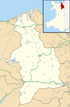
Aberwheeler (Welsh: Aberchwiler) is a village and community in the Welsh county of Denbighshire, located on the south bank of the River Wheeler (Welsh: Afon Chwiler), 4.2 miles (6.8 km) north east of Denbigh, 12.6 miles (20.3 km) north west of Mold and 11.0 miles (17.7 km) north of Ruthin. At the 2001 census the community had a population of 327,[1] reducing to 298 at the 2011 census.[2] The name has been Anglicised from the Welsh.
Aberwheeler
| |
|---|---|
 Aberwheeler | |
Location within Denbighshire | |
| Population | 298 (2011) |
| OS grid reference | SJ095693 |
| Community |
|
| Principal area | |
| Preserved county | |
| Country | Wales |
| Sovereign state | United Kingdom |
| Post town | DENBIGH |
| Postcode district | LL16 |
| Dialling code | 01745 |
| Police | North Wales |
| Fire | North Wales |
| Ambulance | Welsh |
| UK Parliament | |
| Senedd Cymru – Welsh Parliament | |
History
editHistorically, Aberwheeler formed a township of the ancient parish of Bodfari,[3] which also comprised Maesmynan and Blorant. At one point the manor was owned by Gwenllian.[4] A mill was situated in Aberwheeler from medieval times. Aberwheeler mill was burnt in 1403, though it was later leased to Thomas Londisdale and Henry Billiger in November 1408 on the grounds that they rebuild it.[5] Today, further north, on the banks of the river, stands Candy Mill, a clover mill built to extract clover seed.[6][7] The mill is Grade II* listed, while Aberwheeler House and Castell Bach are Grade II listed.[8][9]
Geography
editIn the east of the community, the land climbs steeply to the 1,306 feet (398 m) high summit of Moel y Parc on the boundary with Flintshire, where there is a cairn and tumulus.[10] The Offa's Dyke Path, 176 miles (283 km) long, which runs from Sedbury, in Gloucestershire, to Prestatyn,[11] descends through the community from the heights of the Clwydian Range to cross the River Wheeler into Bodfari.[12]
Notable people
edit- Reverend Edward Williams, clergyman, known as 'the divine', born in Glan Clwyd, Aberwheeler in 1750.[13]
References
edit- ^ "Census 2001: Parish Headcounts: Denbighshire". Neighbourhood Statistics. Office for National Statistics. Archived from the original on 13 June 2011. Retrieved 9 April 2013.
- ^ "community population 2011". Retrieved 23 May 2015.
- ^ Veysey, Arthur Geoffrey (1984). Guide to the Parish Records of Clwyd. Clwyd County Council. p. 14. ISBN 978-0-905349-98-5.
- ^ Richards, Gwenyth (2009). Welsh Noblewomen in the Thirteenth Century: An Historical Study of Medieval Welsh Law and Gender Roles. Edwin Mellen Press. p. 51. ISBN 978-0-7734-4672-4.
- ^ Cylchgrawn Hanes Cymru. University of Wales Press. 1964. p. 320.
- ^ "Candy Mill with Miller's Cottage and Leat, Aberwheeler". British Listed Buildings. Retrieved 10 April 2013.
- ^ "Historic Landscape Characterisation: The Vale of Clwyd: Aberchwiler, Bodfari and Aberwheeler". Clwyd–Powys Archaeological Trust. Retrieved 10 April 2013.
- ^ "Aberwheeler House, Aberwheeler". British Listed Buildings. Retrieved 10 April 2013.
- ^ "Castell Bach, Aberwheeler". British Listed Buildings. Retrieved 10 April 2013.
- ^ Davies, Ellis (1949). The prehistoric and Roman remains of Flintshire: with a short appendix to "The prehistoric and Roman remains of Denbighshire (1929). Printed by William Lewis, Cambrian Works. p. 412.
- ^ Peddicord, Kathleen (1 August 1992). The World's Best. Agora, Incorporated. p. 36. ISBN 978-0-945332-33-6.
- ^ Marriott, Michael (18 October 1982). Mountains and hills of Britain: a guide to the uplands of England, Scotland, and Wales. Willow Books. p. 60. ISBN 978-0-00-218028-3.
- ^ Nicholas, Alvin (30 August 2013). Supernatural Wales. Amberley Publishing Limited. p. 130. ISBN 978-1-4456-1175-4.
