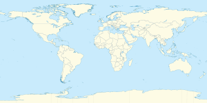
The 7th parallel north is a circle of latitude that is 7 degrees north of the Earth's equatorial plane. It crosses Africa, the Indian Ocean, South Asia, Southeast Asia, the Pacific Ocean, South America, and the Atlantic Ocean.

Line across the Earth
7th parallel north

Around the world

edit

Starting at the Prime Meridian and heading eastwards, the parallel 7° north passes through:

Coordinates Country, territory or sea Notes
7°0′N 0°0′E / 7.000°N 0.000°E / 7.000; 0.000 (Prime Meridian)   Ghana Passing through Lake Volta
7°0′N 0°33′E / 7.000°N 0.550°E / 7.000; 0.550 (Togo)   Togo
7°0′N 1°38′E / 7.000°N 1.633°E / 7.000; 1.633 (Benin)   Benin
7°0′N 2°44′E / 7.000°N 2.733°E / 7.000; 2.733 (Nigeria)   Nigeria
7°0′N 10°7′E / 7.000°N 10.117°E / 7.000; 10.117 (Cameroon)   Cameroon For about 6 km
7°0′N 10°10′E / 7.000°N 10.167°E / 7.000; 10.167 (Nigeria)   Nigeria
7°0′N 10°33′E / 7.000°N 10.550°E / 7.000; 10.550 (Cameroon)   Cameroon For about 17 km
7°0′N 10°42′E / 7.000°N 10.700°E / 7.000; 10.700 (Nigeria)   Nigeria
7°0′N 11°40′E / 7.000°N 11.667°E / 7.000; 11.667 (Cameroon)   Cameroon
7°0′N 15°9′E / 7.000°N 15.150°E / 7.000; 15.150 (Central African Republic)   Central African Republic
7°0′N 26°3′E / 7.000°N 26.050°E / 7.000; 26.050 (South Sudan)   South Sudan
7°0′N 34°16′E / 7.000°N 34.267°E / 7.000; 34.267 (Ethiopia)   Ethiopia
7°0′N 47°1′E / 7.000°N 47.017°E / 7.000; 47.017 (Somalia)   Somalia
7°0′N 49°22′E / 7.000°N 49.367°E / 7.000; 49.367 (Indian Ocean) Indian Ocean
7°0′N 72°52′E / 7.000°N 72.867°E / 7.000; 72.867 (Maldives)   Maldives Northern Thiladhunmathi Atoll[1]
7°0′N 72°58′E / 7.000°N 72.967°E / 7.000; 72.967 (Indian Ocean) Indian Ocean Laccadive Sea – passing just north of the island of Kelaa,   Maldives
7°0′N 79°52′E / 7.000°N 79.867°E / 7.000; 79.867 (Sri Lanka)   Sri Lanka Passing just north of Colombo
7°0′N 81°52′E / 7.000°N 81.867°E / 7.000; 81.867 (Indian Ocean) Indian Ocean Bay of Bengal
7°0′N 93°42′E / 7.000°N 93.700°E / 7.000; 93.700 (India)   India Andaman and Nicobar Islands – island of Great Nicobar
7°0′N 93°57′E / 7.000°N 93.950°E / 7.000; 93.950 (Indian Ocean) Indian Ocean Andaman Sea
7°0′N 99°40′E / 7.000°N 99.667°E / 7.000; 99.667 (Thailand)   Thailand Passing just south of Hat Yai
7°0′N 100°45′E / 7.000°N 100.750°E / 7.000; 100.750 (Gulf of Thailand) Gulf of Thailand
7°0′N 103°2′E / 7.000°N 103.033°E / 7.000; 103.033 (South China Sea) South China Sea
7°0′N 116°43′E / 7.000°N 116.717°E / 7.000; 116.717 (Malaysia)   Malaysia Sabah, island of Borneo – for about 6 km
7°0′N 116°47′E / 7.000°N 116.783°E / 7.000; 116.783 (South China Sea) South China Sea Marudu Bay
7°0′N 117°7′E / 7.000°N 117.117°E / 7.000; 117.117 (Malaysia)   Malaysia Sabah, island of Borneo – for about 3 km
7°0′N 117°9′E / 7.000°N 117.150°E / 7.000; 117.150 (Sulu Sea) Sulu Sea Passing just south of Malawali Island,   Malaysia
7°0′N 118°25′E / 7.000°N 118.417°E / 7.000; 118.417 (Philippines)   Philippines Island of Cagayan de Sulu[2]
7°0′N 118°31′E / 7.000°N 118.517°E / 7.000; 118.517 (Sulu Sea) Sulu Sea
7°0′N 121°55′E / 7.000°N 121.917°E / 7.000; 121.917 (Philippines)   Philippines Island of Mindanao (Zamboanga Peninsula)
7°0′N 122°11′E / 7.000°N 122.183°E / 7.000; 122.183 (Celebes Sea) Celebes Sea Moro Gulf – passing just north of Sacol Island,   Philippines
7°0′N 123°59′E / 7.000°N 123.983°E / 7.000; 123.983 (Philippines)   Philippines Island of Mindanao
7°0′N 125°30′E / 7.000°N 125.500°E / 7.000; 125.500 (Davao Gulf) Davao Gulf
7°0′N 125°43′E / 7.000°N 125.717°E / 7.000; 125.717 (Philippines)   Philippines Island of Samal
7°0′N 125°47′E / 7.000°N 125.783°E / 7.000; 125.783 (Davao Gulf) Davao Gulf
7°0′N 125°59′E / 7.000°N 125.983°E / 7.000; 125.983 (Philippines)   Philippines Island of Mindanao
7°0′N 126°27′E / 7.000°N 126.450°E / 7.000; 126.450 (Pacific Ocean) Pacific Ocean Philippine Sea
7°0′N 134°14′E / 7.000°N 134.233°E / 7.000; 134.233 (Palau)   Palau Island of Peleliu
7°0′N 134°16′E / 7.000°N 134.267°E / 7.000; 134.267 (Pacific Ocean) Pacific Ocean Passing just south of Truk Lagoon,   Federated States of Micronesia
7°0′N 158°14′E / 7.000°N 158.233°E / 7.000; 158.233 (Federated States of Micronesia)   Federated States of Micronesia Parempei island (just to the north of Pohnpei island)
7°0′N 158°15′E / 7.000°N 158.250°E / 7.000; 158.250 (Pacific Ocean) Pacific Ocean Passing just south of Ailinglaplap Atoll,   Marshall Islands
Passing just south of Majuro atoll,   Federated States of Micronesia
7°0′N 171°35′E / 7.000°N 171.583°E / 7.000; 171.583 (Marshall Islands)   Marshall Islands Arno Atoll
7°0′N 171°45′E / 7.000°N 171.750°E / 7.000; 171.750 (Pacific Ocean) Pacific Ocean Passing just south of Jicarón island, and the Azuero Peninsula,   Panama
7°0′N 77°40′W / 7.000°N 77.667°W / 7.000; -77.667 (Colombia)   Colombia
7°0′N 71°1′W / 7.000°N 71.017°W / 7.000; -71.017 (Venezuela)   Venezuela For about 18 km
7°0′N 70°57′W / 7.000°N 70.950°W / 7.000; -70.950 (Colombia)   Colombia
7°0′N 70°26′W / 7.000°N 70.433°W / 7.000; -70.433 (Venezuela)   Venezuela
7°0′N 60°21′W / 7.000°N 60.350°W / 7.000; -60.350 (Area disputed between Guyana and Venezuela) Disputed area Controlled by   Guyana, claimed by   Venezuela
7°0′N 58°27′W / 7.000°N 58.450°W / 7.000; -58.450 (Guyana)   Guyana Island of Wakenaam
7°0′N 58°23′W / 7.000°N 58.383°W / 7.000; -58.383 (Atlantic Ocean) Atlantic Ocean
7°0′N 11°37′W / 7.000°N 11.617°W / 7.000; -11.617 (Sierra Leone)   Sierra Leone
7°0′N 11°27′W / 7.000°N 11.450°W / 7.000; -11.450 (Liberia)   Liberia
7°0′N 8°17′W / 7.000°N 8.283°W / 7.000; -8.283 (Côte d'Ivoire)   Ivory Coast
7°0′N 3°7′W / 7.000°N 3.117°W / 7.000; -3.117 (Ghana)   Ghana

See also

edit

References

edit
  1. ^ Godfrey, T. (2018). Atlas of the Maldives, 6th Edition (2018). Atoll Editions. p. 2. ISBN 978-1-876410-03-2. Retrieved 13 November 2024.
  2. ^ Solheim II, William G. (April 1973). "Remarks on the Prehistory of Sabah and Southeast Asian Archaeology" (PDF). Borneo Research Bulletin. 5 (1). West Lafayette, Indiana, USA: Borneo Research Council: 3–6. Retrieved 13 November 2024.