The meridian 26° west of Greenwich is a line of longitude that extends from the North Pole across the Arctic Ocean, Greenland, the Atlantic Ocean, the Southern Ocean, and Antarctica to the South Pole.

Line across the Earth
26°
26th meridian west

The 26th meridian west forms a great circle with the 154th meridian east.

From Pole to Pole

edit

Starting at the North Pole and heading south to the South Pole, the 26th meridian west passes through:

The line is historically important because on 18 April 1941 the United States government used it as the demarcation between the Western and Eastern Hemispheres for the period of hostilities leading up to its participation in the Second World War. This influenced Britain's proposed occupation of the Canary Islands in its planned (but never executed) Operation Pilgrim. After the war began the boundary was moved to the 35th meridian west for purposes of service, as specified in the American Campaign Medal.
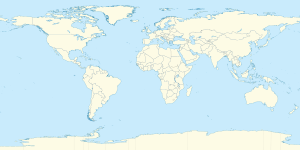
Co-ordinates Country, territory or sea Notes
90°0′N 26°0′W / 90.000°N 26.000°W / 90.000; -26.000 (Arctic Ocean) Arctic Ocean
83°21′N 26°0′W / 83.350°N 26.000°W / 83.350; -26.000 (Greenland)   Greenland Northern Peary Land
83°14′N 26°0′W / 83.233°N 26.000°W / 83.233; -26.000 (Frederick E. Hyde Fjord) Frederick E. Hyde Fjord
83°8′N 26°0′W / 83.133°N 26.000°W / 83.133; -26.000 (Greenland)   Greenland Southern Peary Land
82°10′N 26°0′W / 82.167°N 26.000°W / 82.167; -26.000 (Independence Fjord) Independence Fjord
82°1′N 26°0′W / 82.017°N 26.000°W / 82.017; -26.000 (Greenland)   Greenland
81°36′N 26°0′W / 81.600°N 26.000°W / 81.600; -26.000 (Hagen Fjord) Hagen Fjord
81°29′N 26°0′W / 81.483°N 26.000°W / 81.483; -26.000 (Greenland)   Greenland Mainland and the island of Milne Land
70°32′N 26°0′W / 70.533°N 26.000°W / 70.533; -26.000 (Scoresby Sund) Scoresby Sund
70°16′N 26°0′W / 70.267°N 26.000°W / 70.267; -26.000 (Greenland)   Greenland
68°47′N 26°0′W / 68.783°N 26.000°W / 68.783; -26.000 (Atlantic Ocean) Atlantic Ocean Passing just west of São Miguel Island, Azores,   Portugal (at 37°51′N 25°51′W / 37.850°N 25.850°W / 37.850; -25.850 (São Miguel Island))
Passing just east of Saunders Island,   South Georgia and the South Sandwich Islands (at 57°47′S 26°20′W / 57.783°S 26.333°W / -57.783; -26.333 (Saunders Island))
Passing just east of Montagu Island,   South Georgia and the South Sandwich Islands (at 58°28′S 26°13′W / 58.467°S 26.217°W / -58.467; -26.217 (Montagu Island))
60°0′S 26°0′W / 60.000°S 26.000°W / -60.000; -26.000 (Southern Ocean) Southern Ocean
75°23′S 26°0′W / 75.383°S 26.000°W / -75.383; -26.000 (Antarctica) Antarctica Claimed by both   Argentina (Argentine Antarctica) and   United Kingdom (British Antarctic Territory)

See also

edit

References

edit