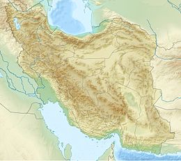
The 2019 East Azerbaijan earthquake occurred at 03:17 local-time on November 8, 2019. This earthquake had a moment magnitude of 5.9 and had a shallow depth of 20 km.[2]
| UTC time | 2019-11-08 22:47:07 |
|---|---|
| ISC event | 616764888 |
| USGS-ANSS | ComCat |
| Local date | 8 November 2019 |
| Local time | 03:17 (UTC+4:30) |
| Magnitude | 5.9 Mw |
| Depth | 20 km (12 mi) |
| Epicenter | 37°48′11″N 47°34′52″E / 37.803°N 47.581°E |
| Areas affected | Iran |
| Max. intensity | MMI VII (Very strong) |
| Aftershocks | More than 610, largest is magnitude 4.8[1] |
| Casualties | 7 dead, 584 injured |
Tectonic setting
editIran lies within the complex zone of continental collision between the Arabian Plate and the Eurasian Plate, which extends from the Bitlis-Zagros belt in the south to the Greater Caucasus Mountains, the Absheron-Balkan Sill and the Kopet Dag mountains in the north.[3] The collision between these plates deforms an area of ~ 3,000,000 km2 of continental crust. It is one of the largest convergent deformation regions on Earth.[4] In northwestern Iran, the Arabian Plate is moving northwards at about 20 mm per year relative to the Eurasian Plate, somewhat oblique to the plate boundary zone. The deformation in the area near Tabriz is dominated by the North Tabriz Fault, a WNW–ESE trending right-lateral strike-slip fault, which has been responsible for 7 historical earthquakes of magnitude greater than 6 since AD 858.[5] Other known active faults include a W-E trending fault between the cities of Ahar and Heris.[6] This same setting caused a magnitude 6.4 earthquake in August 2012, killing at least 38 and injured more than 3,200, 268 of which died later in hospitals.[7][8]
Earthquake
edit| Modified Mercalli intensities in selected locations[2] | ||
| MMI | Locations | Population exposure |
|---|---|---|
| MMI VII (Very strong) | Sarab | 77,000 |
| MMI VI (Strong) | Hashtrud | 83,000 |
| MMI V (Moderate) | Tabriz | 1.28 million |
| MMI IV (Light) | Ardabil | 6.45 million |
The magnitude 5.9 earthquake was a result of strike-slip faulting approximately 250 km to the northeast of the plate boundary between the Arabian Plate and Eurasian Plate plate.[2] The focal mechanism indicated faulting in a left-lateral sense beneath Mount Bozgush. Aftershocks distribution suggest rupture along a NE–SW plane. It is thought to have ruptured along a buried parallel splay branch of the Shalgun–Yelimsi Fault. A fault dimension of 3.8 × 4.9 km2 was estimated, buried beneath the surface. It produced a maximum slip of 0.8 meter at 5 km depth, while a large area of slip occurred at between 2 km and 11 km depth.[9]
Impact
editDamage and casualties
editSix cities and 145 villages with a combined population of 121,307 were affected by the earthquake, out of which thirty were completely destroyed.[10] The most affected areas in East Azerbaijan Province were the towns of Miyaneh and Sarab. Some livestock were also killed due to the collapse of barns and sheds.[11] The earthquake caused landslides and damaged transportation routes, telecommunication, water sewages, and caused fires due to the damage of gas pipelines. Five people were killed in the earthquake and 66 were injured by falling debris. 518 others were injured due to quake-caused panic, and two others died due to carbon monoxide poisoning from fires caused by the quake.[12]
Moderate shaking was felt in Tabriz, where six houses collapsed and over 400 were damaged.[11][13]
Relief
edit3,091 tents, over 3,000 food parcels, 3,521 blankets, 4,595 bottles of water, 440 kitchen sets and 350 pieces of bread were sent to displaced victims of the earthquake.[12]
See also
editReferences
edit- ^ Ghasemi, Afshan; Saidi, Shahla; Ganjaian, Hamid; Gardhan, Saeed (2019). "مطالعه جابهجایی قائم حاصل از زمینلرزه 17/8/98 ترکمانچای با استفاده از روش InSAR" [A study of the vertical displacement resulting from the 17/8/98 Turkmanchai earthquake using the InSAR method]. Journal of the Earth and Space Physics (in Persian). 46 (3): 445–456. doi:10.22059/JESPHYS.2020.295046.1007182.
- ^ a b c "M 5.9 – 59 km NE of Hashtr?d, Iran". earthquake.usgs.gov.
- ^ Talebian, M.; Jackson J. (2004). "A reappraisal of earthquake focal mechanisms and active shortening in the Zagros mountains of Iran". Geophysical Journal International. 156 (3): 506–526. Bibcode:2004GeoJI.156..506T. doi:10.1111/j.1365-246X.2004.02092.x.
- ^ Allen, M.; Jackson J. & Walker R. (2004). "Late Cenozoic reorganization of the Arabia-Eurasia collision and the comparison of short-term and long-term deformation rates". Tectonics. 23 (2): n/a. Bibcode:2004Tecto..23.2008A. doi:10.1029/2003tc001530.
- ^ Moradi, A.S.; Hatzfeld D. & Tatar M. (2011). "Microseismicity and seismotectonics of the North Tabriz fault (Iran)". Tectonophysics. 506 (1–4): 22–30. Bibcode:2011Tectp.506...22M. doi:10.1016/j.tecto.2011.04.008.
- ^ Hoseinpour, M.; Zare M. (2009). "Seismic Hazard Assessment of Tabriz, a City in the Northwest of Iran" (PDF). Science Information Database. Retrieved 12 August 2012.
- ^ "M 6.4 – 26 km SW of Ahar, Iran". 11 August 2012. Retrieved 1 August 2021.
- ^ Torbati, Yeganeh (12 August 2012). "Two earthquakes in Iran kill 250 and injure 2,000". Reuters. Dubai. Retrieved 12 August 2012.
- ^ Yang, Jiuyuan; Xu, Caijun; Wen, Yangmao (2020). "The 2019 Mw 5.9 Torkaman chay earthquake in Bozgush mountain, NW Iran: A buried strike-slip event related to the sinistral Shalgun-Yelimsi fault revealed by InSAR". Journal of Geodynamics. 141–142: 141–142. Bibcode:2020JGeo..14101798Y. doi:10.1016/j.jog.2020.101798. S2CID 228958708.
- ^ "5.9 quake in northwestern Iran kills 5, destroys 30 villages". kurdistan24.net.
- ^ a b "Deadly magnitude 5.9 earthquake hits northwestern Iran". aljazeera.com.
- ^ a b "Iran: Earthquake – Information Bulletin (13 Nov 2019) – Iran (Islamic Republic of)". ReliefWeb. 13 November 2019. Retrieved 2019-11-14.
- ^ "Magnitude 5.9 earthquake kills 5, injures 300 in Iran". dailysabah.com. 8 November 2019.
External links
edit- The International Seismological Centre has a bibliography and/or authoritative data for this event.

