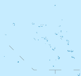
Wotho Atoll (Marshallese: Wōtto, [wʌttˠɔ])[1] is a coral atoll of 13 islands in the Pacific Ocean, and forms a legislative district of the Ralik Chain of the Marshall Islands. Its total land area is only 4.33 square kilometers (1.67 sq mi), but it encloses a lagoon of 94.92 square kilometers (36.65 sq mi). The name "Wotho" means either "entrance through the reef", or "island far away" according to different sources.
 NASA picture of Wotho Atoll | |
 Wotho Atoll (Marshall Islands) | |
| Geography | |
|---|---|
| Location | North Pacific |
| Coordinates | 10°05′00″N 165°50′00″E / 10.08333°N 165.83333°E |
| Archipelago | Ralik |
| Total islands | 13 |
| Area | 4.33 km2 (1.67 sq mi) |
| Highest elevation | 3 m (10 ft) |
| Administration | |
| Demographics | |
| Population | 88 (2021) |
| Ethnic groups | Marshallese |
The population of Wotho Atoll was 88 at the 2021 census.[2]
History
editFirst recorded sighting of Wotho Atoll by Europeans was by the Spanish expedition of Miguel López de Legazpi on 12 January 1565. They were charted as Las Hermanas (The Sisters in Spanish). It is likely that it had been visited earlier, in between December 1542 and January 1543, by the Spanish expedition of Ruy López de Villalobos.[3][4] The atoll was later also known as Schantz Islands after Johan Eberhard von Schantz, who rediscovered the islands on his circumnavigation of the globe on the Imperial Russian Navy ship America in 1835.[5] Wotho Atoll was claimed by the German Empire along with the rest of the Marshall Islands in 1885.[6] After World War I, the island came under the South Seas Mandate of the Empire of Japan. At the end of World War II, it came under the control of the United States as part of the Trust Territory of the Pacific Islands until the independence of the Marshall Islands in 1986.
Education
editMarshall Islands Public School System operates Wotho Elementary School.[7] Kwajalein Atoll High School on Kwajalein serves the community.[8]
References
edit- ^ Marshallese-English Dictionary - Place Name Index
- ^ "Republic of the Marshall Islands 2021 Census Report, Volume 1: Basic Tables and Administrative Report" (PDF). Pacific Community (SPC): Statistics for Development Division. Pacific Community. May 30, 2023. Retrieved September 27, 2023.
- ^ Sharp, Andrew The discovery of the Pacific Islands Oxford, 1960, p.32,38,39.
- ^ Brand, Donald D. The Pacific Basin: A History of its Geographical Explorations The American Geographical Society, New York, 1967, p.129.
- ^ von Schantz, Johan Eberhard (in Finnish)
- ^ Churchill, William (1920). "Germany's Lost Pacific Empire". Geographical Review. 10 (2): 84. JSTOR 207706.
- ^ "Public Schools Archived 2018-02-21 at the Wayback Machine." Marshall Islands Public School System. Retrieved on February 21, 2018.
- ^ "Annual Report 2011-2012 Archived 2018-02-22 at the Wayback Machine." Ministry of Education (Marshall Islands). Retrieved on February 22, 2018. p. 54 (PDF p. 55/118). "Kwajalein Atoll High School enrolls students from Kwajalein and the Kabinmeto zone including schools in Ujae, Lae, and Wotto."
External links
edit- Marshall Islands site
- Entry at Oceandots.com at the Wayback Machine (archived December 23, 2010)
