Poltár is a town and municipality in the Poltár District in the Banská Bystrica Region of Slovakia.
Poltár | |
|---|---|
Town | |
 Turkish bridge in Poltár | |
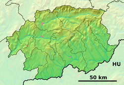
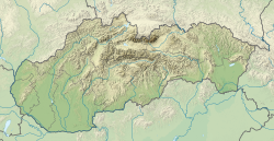
Location of Poltár in the Banská Bystrica Region | |
| Coordinates: 48°25′50″N 19°47′51″E / 48.43056°N 19.79750°E | |
| Country | |
| Region | Banská Bystrica |
| District | Poltár |
| First mentioned | 1246 |
| Government | |
| • Mayor | Peter Sitor |
| Area | |
• Total | 30.53 km2 (11.79 sq mi) |
| (2022) | |
| Elevation | 242[2] m (794[2] ft) |
| Population | |
• Total | 5,187 |
| • Density | 170/km2 (440/sq mi) |
| Time zone | UTC+1 (CET) |
| • Summer (DST) | UTC+2 (CEST) |
| Postal code | 987 01[2] |
| Area code | +421 47[2] |
| Car plate | PT |
| Website | www.poltar.sk |
Geography
editThe town is located in the Southern Slovak basin near the river Ipeľ, south of the Revúcka Hills, which is part of the Slovak Ore Mountains, around 18 km (11.18 mi) from Lučenec.
History
editThere were historical Slavic remains of ancient housing, probably from the 7th century. After that remains of small medieval castle are part of Poltár's history, found in the general area and in the town part of Kostolisko (Literally meaning "Place of Church") there are remains of romancatholic church. Poltár was first mentioned in 1246 as silva Polta. Some other names are Nagpolthar, Felsupolthar, Kyspoltar, Varalyapolthar (1409) and Polthar (1439). In the 16th century the town was divided into Horný Poltár and Dolný Poltár. In the same general time, it was occupied by the Ottomans (between 1554 and 1593). In the year 1828 there were only mere 83 houses and 56 citizens. In the same timeframe, the town of Poltár was very agricultural, which wasn't profitable for the town. From 1869 and onwards, the factory of Barratt-Dragon was built, with its primary focus being the creation of bricks and tiles. Before the establishment of independent Czechoslovakia in 1918, Poltár was part of Nógrád County within the Kingdom of Hungary. From 1939 to 1945, it was part of the Slovak Republic.
From 1922, a steam sawmill was built, but burnt down fourteen years later in 1936. The citizens of Poltár were also very active in the Slovak National Uprising. In the year 1966 Poltár joins the towns of Slaná lehota and Zelené, receiving the city privileges.
Parts of Poltár
editPodháj - built during the late medieval era by the Sóós family. It was destroyed during the Ottoman occupation during 1554-1562. It was rebuilt around the 17th century, but only as a small village.
Prievrana - built during the late medieval era. It was destroyed during the multiple military actions in the area roughly around 1610. It was rebuilt in the 17th century, only as a small village. Its other names (mainly Hungarian) were Prenna and Perenna.
Slaná Lehota - built in the second half of the 14th century. The town was owned by Fiľakovo. Between the years 1554-1593 it was occupied by the Ottomans. After that, in 1598 the Sóós family became the owners. In 17th and 18th century Geczy family became the owners. In the year 1828 it had 23 houses and 130 citizens.
Zelené - Founded approximately in the 14th century. It was owned by many families during its history. It was occupied by the Ottomans in 1554-1593. In the year 1828 it had 28 houses and 274 citizens. The town helped the Slovak National Uprising movement.
Demographics
edit| Year | Pop. | ±% |
|---|---|---|
| 1970 | 3,105 | — |
| 1980 | 5,030 | +62.0% |
| 1991 | 5,823 | +15.8% |
| 2001 | 6,099 | +4.7% |
| 2011 | 5,826 | −4.5% |
| 2021 | 5,333 | −8.5% |
| Source: Censuses[4][5] | ||
According to the 2001 census, the town had 6,099 inhabitants. 97.49% of inhabitants were Slovaks, 0.95% Roma, 0.51% Hungarians and 0.41% Czechs.[6] The religious make-up was 50.14% Roman Catholics, 22.89% people with no religious affiliation and 20.79% Lutherans.[6]
People
edit- Ivan Gašparovič, the former President of Slovakia was born here.
References
edit- ^ Statistical Office of the Slovak Republic (www.statistics.sk). "Hustota obyvateľstva - obce". www.statistics.sk. Retrieved 2024-02-08.
- ^ a b c d "Základná charakteristika". www.statistics.sk (in Slovak). Statistical Office of the Slovak Republic. 2015-04-17. Retrieved 2022-03-31.
- ^ Statistical Office of the Slovak Republic (www.statistics.sk). "Počet obyvateľov podľa pohlavia - obce (ročne)". www.statistics.sk. Retrieved 2024-02-08.
- ^ "Statistical lexikon of municipalities 1970-2011" (PDF) (in Slovak).
- ^ "Census 2021 - Population - Basic results". Statistical Office of the Slovak Republic. 2021-01-01.
- ^ a b "Municipal Statistics". Statistical Office of the Slovak republic. Archived from the original on 2007-12-17. Retrieved 2007-12-28.
External links
edit- Media related to Poltár at Wikimedia Commons
- Official website
- Municipal website (in Slovak)


