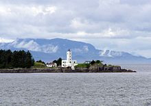
Petersburg Borough is a borough in the U.S. state of Alaska. According to the 2020 census, the population was 3,398.[2] The borough seat is Petersburg.[3]
Petersburg Borough | |
|---|---|
 | |
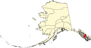
 Location within the U.S. state of Alaska | |
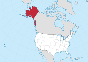
 Alaska's location within the U.S. | |
| Coordinates: 56°48′16″N 132°56′31″W / 56.8044°N 132.9419°W | |
| Country | |
| State | |
| Incorporated | January 3, 2013[1] |
| Named for | Petersburg |
| Seat | Petersburg |
| Largest CDP | Petersburg |
| Area | |
• Total | 3,829 sq mi (9,920 km2) |
| Population (2020) | |
• Total | 3,360 |
| • Density | 0.88/sq mi (0.34/km2) |
| Time zone | UTC−9 (Alaska) |
| • Summer (DST) | UTC−8 (ADT) |
| Congressional district | At-large |
| Website | www |
History
editWhen the borough was incorporated in 2013, it took area from the Hoonah-Angoon Census Area and the former Petersburg Census Area. The remaining portion of Petersburg Census Area (including Kake) was added to Prince of Wales-Hyder Census Area. Petersburg Census Area was created in 2008 from the remaining portion of Wrangell-Petersburg Census Area upon the incorporation of the City and Borough of Wrangell.[4]
Geography
editLocated in central Southeast Alaska, the Petersburg Borough encompasses approximately 3,829 square miles (2,921 square miles of land, 908 square miles of water).
Adjacent boroughs and census area
edit- Juneau Borough, Alaska - northwest (quadripoint)[5]
- Wrangell Borough, Alaska - southeast
- Prince of Wales-Hyder Census Area, Alaska - southwest
- Hoonah–Angoon Census Area - north and west
- Regional District of Kitimat-Stikine, British Columbia, Canada - east
Politics
editPetersburg is strongly Republican, having last been carried by a Democrat in 1968.
| Year | Republican | Democratic | Third party(ies) | |||
|---|---|---|---|---|---|---|
| No. | % | No. | % | No. | % | |
| 2020 | 1,002 | 62.31% | 534 | 33.21% | 72 | 4.48% |
| 2016 | 928 | 53.70% | 577 | 33.39% | 223 | 12.91% |
| 2012 | 867 | 50.12% | 777 | 44.91% | 86 | 4.97% |
| 2008 | 963 | 55.96% | 704 | 40.91% | 54 | 3.14% |
| 2004 | 753 | 59.62% | 452 | 35.79% | 58 | 4.59% |
| 2000 | 1,125 | 63.99% | 403 | 22.92% | 230 | 13.08% |
| 1996 | 727 | 44.79% | 584 | 35.98% | 312 | 19.22% |
| 1992 | 583 | 33.37% | 578 | 33.09% | 586 | 33.54% |
| 1988 | 712 | 54.10% | 562 | 42.71% | 42 | 3.19% |
| 1984 | 898 | 52.64% | 774 | 45.37% | 34 | 1.99% |
| 1980 | 727 | 53.42% | 395 | 29.02% | 239 | 17.56% |
| 1976 | 616 | 61.54% | 332 | 33.17% | 53 | 5.29% |
| 1972 | 506 | 63.09% | 254 | 31.67% | 42 | 5.24% |
| 1968 | 438 | 46.70% | 447 | 47.65% | 53 | 5.65% |
| 1964 | 220 | 23.23% | 727 | 76.77% | 0 | 0.00% |
| 1960 | 391 | 52.41% | 355 | 47.59% | 0 | 0.00% |
Demographics
edit| Census | Pop. | Note | %± |
|---|---|---|---|
| 2020 | 3,398 | — | |
| 2023 (est.) | 3,427 | [7] | 0.9% |
| U.S. Decennial Census[8] | |||
As of the 2020 census, there were 3,398 people living in the borough. The population density was 0.89 per square mile (0.34/km2). There were 1,718 housing units. The racial makeup of the borough was 2,870 White, 92 Black or African American, 483 Native American, 209 Asian, 58 Pacific Islander, and 206 from other races. 164 of the population were Hispanic or Latino of any race.[2]
Communities
editCity
editCensus-designated places
edit- Hobart Bay
- Petersburg (borough seat)
See also
editReferences
edit- ^ "Vote certified, Petersburg Borough formation complete". KTOO. January 4, 2013. Retrieved July 23, 2013.
- ^ a b "2020 Census Data - Cities and Census Designated Places" (Web). State of Alaska, Department of Labor and Workforce Development. Retrieved October 31, 2021.
- ^ "Find a County". National Association of Counties. Retrieved June 7, 2011.
- ^ U.S. Geological Survey Geographic Names Information System: Petersburg Borough, Alaska, U.S. Geological Survey Geographic Names Information System: Wrangell City and Borough
- ^ Juneau Empire, 28 October 2012, Juneau appeals Petersburg Borough boundary approval – Includes map.
- ^ "RRH Elections". rrhelections.com. February 2, 2018. Retrieved December 24, 2021.
- ^ "Annual Estimates of the Resident Population for Counties: April 1, 2020 to July 1, 2023". United States Census Bureau. Retrieved March 28, 2024.
- ^ "Census of Population and Housing". Census.gov. Retrieved November 21, 2021.
External links
edit- Official website
- Petersburg Chamber of Commerce [1]
- Petersburg Public Access Atlas (Alaska DNR)
- Map of the former census area