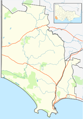
Paschendale is a locality in south west Victoria, Australia. The locality is in the Shire of Glenelg, 352 kilometres (219 mi) west of the state capital, Melbourne.
| Paschendale Victoria | |
|---|---|
 Entering Paschendale, 2015 | |
| Coordinates | 37°39′6″S 141°34′50″E / 37.65167°S 141.58056°E |
| Population | 30 (2016 census)[1] |
| Postcode(s) | 3315 |
| Location | |
| LGA(s) | Shire of Glenelg |
| State electorate(s) | Lowan |
| Federal division(s) | Wannon |
At the 2016 census, Paschendale had a population of 30.[1]
Traditional ownership
editThe formally recognised traditional owners of the area on which Paschendale is sited are the Gunditjmara People[2] who are represented by the Gunditj Mirring Traditional Owners Aboriginal Corporation.[3]
European history
editIn 1841, brothers William and John Robertson, from Inverness-shire, Scotland, occupied land in the area as a pastoral run. The property fronted the Wannon River and the brothers named it "Struan". Their older brother, Angus, took over the running of the property in 1852 after arriving from Scotland with his wife and six children.
In 1919, the Victorian government purchased Struan from its then owner, and the Closer Settlement Board divided it into 39 soldier settlement blocks. The estate had an area of 1,613 acres (653 ha) is was about 5 miles (8 km) north-east of the town of Merino.[4]
The settlement was named Paschendale, after Passchendaele in Belgium, the scene of intense fighting during World War I. The new settlers built a community hall, tennis courts and a church (previously the Henty Anglican Church), and a state school was opened in 1923.[5]
References
edit- ^ a b Australian Bureau of Statistics (27 June 2017). "Paschendale". 2016 Census QuickStats. Retrieved 11 July 2017.
- ^ "Map of formally recognised traditional owners". Aboriginal Victoria. Retrieved 2 June 2020.
- ^ "Gunditj Mirring Traditional Owners Aboriginal". Gunditj Mirring Traditional Owners Aboriginal Corporation. Retrieved 2 June 2020.
- ^ ""Struan" later renamed "Paschendale" Estate". Casterton and District Historical Society. Retrieved 12 November 2024.
- ^ "Paschendale SS 4107". Casterton and District Historical Society. Retrieved 12 November 2024.
External links
editMedia related to Paschendale, Victoria at Wikimedia Commons
