Mount Twynam is a mountain located on the Main Range, part of the Great Dividing Range, in the Snowy Mountains in New South Wales, Australia. The mountain is located close the border between New South Wales and Victoria.
| Mount Twynam | |
|---|---|
 Mount Twynam as seen from the top of Little Twynam. | |
| Highest point | |
| Elevation | 2,195 m (7,201 ft)[1][2] |
| Prominence | 155 m (509 ft)[1] |
| Isolation | 6.03 km (3.75 mi)[1] |
| Listing | |
| Coordinates | 36°23′36″S 148°18′53″E / 36.39333°S 148.31472°E[3] |
| Geography | |
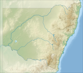
Location in New South Wales | |
| Location | Snowy Mountains, New South Wales, Australia |
| Parent range | Main Range, Great Dividing Range |
| Climbing | |
| Easiest route | Walk (track) |
With an elevation of 2,195 metres (7,201 ft) above sea level, Mount Twynam is the 3rd-highest mountain on mainland Australia. It is located 8 kilometres (5.0 mi) north-east of Mount Kosciuszko.[4]
The mountain is large but unimposing, and has good and far-reaching views over Blue Lake Cirque and the Western Falls. Despite being relatively accessible by track, it is rarely visited.[5] The mountain forms a watershed for the Snowy River to the southeast and the Geehi River to the northwest.[1]
Gallery
edit-
Topographic map of Mount Twynam.
See also
editReferences
edit- ^ a b c d "Mount Twynam, Australia". Peakbagger.com. Peakbagger.com. Retrieved 23 April 2014.
- ^ "Map of Mount Twynam, NSW". Bonzle Digital Atlas of Australia. Retrieved 28 May 2015.
- ^ "Mount Twynam". Geographical Names Register (GNR) of NSW. Geographical Names Board of New South Wales. Retrieved 27 May 2015.
- ^ "Mount Twynam - NSW". ExplorOz. I.T. Beyond Pty Ltd. 2015. Retrieved 27 May 2015.
- ^ Geehi Bushwalking Club (2001). Snowy Mountains Walks (8th ed.). Canberra: National Capital Printing. ISBN 0-9599651-4-9.
