| Photograph |
Name |
County |
Coordinates |
Type |
Age
|
 |
Aghanaglack |
Fermanagh |
|
court tomb (double) |
-
|
 |
Annadorn Dolmen |
Down |
54°20′31.75″N 5°48′12.52″W / 54.3421528°N 5.8034778°W / 54.3421528; -5.8034778 (Annadorn Dolmen) |
passage tomb[1] |
-
|
 |
Ardgroom |
Cork |
51°44′23.23″N 9°53′37.9″W / 51.7397861°N 9.893861°W / 51.7397861; -9.893861 (Ardgroom) |
stone circle |
-
|
 |
Audleystown Court Tomb |
Down |
54°22′29.13″N 5°35′58.08″W / 54.3747583°N 5.5994667°W / 54.3747583; -5.5994667 (Audleystown Court Tomb) |
court tomb |
-
|
 |
Aughlish |
Londonderry |
54°53′46″N 7°02′28″W / 54.896°N 7.041°W / 54.896; -7.041 (Aughlish) |
stone circles |
-
|
| - |
Ballinran Court Tomb |
Down |
- |
court tomb |
-
|
| - |
Ballyalton Court Tomb |
Down |
54°19′44″N 5°38′47″W / 54.3288°N 5.6463°W / 54.3288; -5.6463 (Ballyalton Court Tomb) |
court tomb |
-
|
| - |
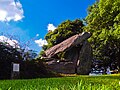
Ballyedmonduff Wedge Tomb
|
Dublin |
- |
wedge tomb |
-
|
 |
Ballykeel Dolmen |
Armagh |
54°08′12″N 6°28′16″W / 54.136696°N 6.471204°W / 54.136696; -6.471204 (Ballykeel Dolmen) |
portal tomb |
-
|
 |
Ballylumford Dolmen |
Antrim |
54°50′30″N 5°46′26″W / 54.84167°N 5.77389°W / 54.84167; -5.77389 (Ballylumford Dolmen) |
portal tomb |
4000 years
|
 |
Ballymacaldrack Court Tomb |
Antrim |
55°0′5.9″N 6°24′15.3″W / 55.001639°N 6.404250°W / 55.001639; -6.404250 (Ballymacaldrack Court Tomb) |
court tomb |
-
|
 |
Ballynoe stone circle |
Down |
54°17′27″N 5°43′35″W / 54.290937°N 5.726292°W / 54.290937; -5.726292 (Ballynoe Stone Circle) |
stone circle |
-
|
 |
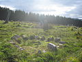
Beaghmore |
Tyrone |
54°42′14″N 6°56′11″W / 54.70389°N 6.93639°W / 54.70389; -6.93639 (Beaghmore) |
stone circles, cairns |
-
|
| - |
Beenalaght |
Cork |
- |
stone row |
-
|
 |
Beltany stone circle |
Donegal |
54°51.025′N 7°36.28′W / 54.850417°N 7.60467°W / 54.850417; -7.60467 (Beltany stone circle) |
stone circle |
-
|
 |
Bocan Stone Circle |
Donegal |
55°16′20″N 7°08′53″W / 55.27222°N 7.14805°W / 55.27222; -7.14805 (Bocan Stone Circle) |
stone circle |
-
|
| - |
Bohonagh |
Cork |
51°34′48″N 8°59′56″W / 51.580102°N 8.998987°W / 51.580102; -8.998987 (Bohonagh) |
stone circle |
-
|
 |
Brownshill Dolmen |
Carlow |
- |
portal tomb |
5000–6000 years
|
| - |
Carnfree |
Roscommon |
- |
cairns, standing stones |
-
|
 |
Carrigagulla |
Cork |
- |
stone circles, stone rows |
-
|
 |
Carrowkeel Tombs |
Sligo |
54°03′12″N 8°22′40″W / 54.05333°N 8.37778°W / 54.05333; -8.37778 (Carrowkeel Tombs) |
passage tombs |
5100–5400 years
|
 |
Carrowmore |
Sligo |
54°15′03.08″N 8°31′09.00″W / 54.2508556°N 8.5191667°W / 54.2508556; -8.5191667 (Carrowmore) |
various |
-
|
 |
Castlenalacht Stone Row |
Cork |
- |
Stone row |
-
|
 |
Castlestrange stone |
Roscommon |
- |
standing stone |
-
|
 |
Cloghanmore |
Donegal |
- |
court tomb |
-
|
 |
Cohaw |
Cavan |
- |
court tomb |
-
|
 |
Corick |
Londonderry |
54°44′53″N 6°47′28″W / 54.748°N 6.791°W / 54.748; -6.791 (Corick) |
stone circles |
-
|
 |
Coom Wedge Tomb |
Kerry |
51°49′24.7″N 10°18′48.9″W / 51.823528°N 10.313583°W / 51.823528; -10.313583 (Coom) |
wedge tomb |
-
|
| - |
Craigs Dolmen |
Antrim |
55°00′07″N 6°28′26″W / 55.00194°N 6.47389°W / 55.00194; -6.47389 (Craigs Dolmen) |
passage tomb |
-
|
 |
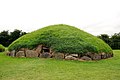
Dowth
(part of Brú na Bóinne) |
Meath |
53°42′10.5″N 6°26′57″W / 53.702917°N 6.44917°W / 53.702917; -6.44917 (Dowth) |
passage tomb |
-
|
 |
Drombeg stone circle |
Cork |
51°33′52″N 9°05′13″W / 51.564553°N 9.08702°W / 51.564553; -9.08702 (Drombeg stone circle) |
recumbent stone circle |
-
|
 |
Drumskinny |
Fermanagh |
54°35′04″N 7°41′26″W / 54.58443°N 7.69051°W / 54.58443; -7.69051 (Drumskinny) |
stone circle, cairn |
-
|
| - |
Eightercua |
Kerry |
51°48′54″N 10°09′29″W / 51.81491°N 10.15807°W / 51.81491; -10.15807 (Eightercua) |
stone row |
3700 years
|
 |
Faulagh |
Mayo |
54°16′00″N 9°47′00″W / 54.26667°N 9.78333°W / 54.26667; -9.78333 (Faulagh) |
various |
-
|
| - |
Gartnanoul |
Cavan |
- |
court tomb |
-
|
 |
Giant's Ring |
Down |
54°32′25″N 5°57′0″W / 54.54028°N 5.95000°W / 54.54028; -5.95000 (Giant's Ring) |
passage tomb[2] |
-
|
 |
Glantane East |
Cork |
52°00′16″N 9°02′41″W / 52.004426°N 9.04485°W / 52.004426; -9.04485 (Glantane East) |
various |
-
|
 |
Goward Dolmen |
Down |
54°12′53″N 6°05′29″W / 54.21464°N 6.09132°W / 54.21464; -6.09132 (Goward Dolmen) |
portal tomb |
-
|
 |
Grange stone circle |
Limerick |
52°30′51.45″N 8°32′30.45″W / 52.5142917°N 8.5417917°W / 52.5142917; -8.5417917 (Grange stone circle) |
stone circle |
-
|
 |
Kealkill stone circle |
Cork |
51°44′43″N 9°22′15″W / 51.7452°N 9.3707°W / 51.7452; -9.3707 (Kealkill stone circle) |
stone circle |
-
|
 |
Kilclooney More |
Donegal |
54°49′04″N 8°25′59″W / 54.817718°N 8.4331537°W / 54.817718; -8.4331537 |
two portal tombs, one court tomb |
|
 |
Kilmashogue |
Dublin |
- |
wedge tomb, portal tombs, standing stones |
-
|
 |
Kilmogue |
Kilkenny |
52°24′11″N 7°15′44″W / 52.403143°N 7.262261°W / 52.403143; -7.262261 (Kilmogue) |
portal tomb |
|
 |
Knockmany Passage Tomb |
Tyrone |
54°26′51″N 7°9′34″W / 54.44750°N 7.15944°W / 54.44750; -7.15944 (Knockmany) |
passage tomb |
|
 |
Knockmaree Dolmen |
Dublin |
53°21′4″N 6°20′30″W / 53.35111°N 6.34167°W / 53.35111; -6.34167 (Knockmaree) |
cist |
|
 |
Knocknakilla |
Cork |
52°00′24″N 9°01′28″W / 52.00680°N 9.02448°W / 52.00680; -9.02448 (Knocknakilla) |
stone circle, standing stone |
|
 |
Knockroe Passage Tomb |
Kilkenny |
52°25′54″N 7°23′59″W / 52.43167°N 7.39972°W / 52.43167; -7.39972 (Knockroe) |
passage tomb |
|
 |
Knocknarea |
Sligo |
54°15′32″N 8°34′29″W / 54.25891°N 8.57463°W / 54.25891; -8.57463 (Knocknarea) |
various |
-
|
 |
Knowth
(part of Brú na Bóinne) |
Meath |
53°42′06″N 6°29′30″W / 53.70167°N 6.49167°W / 53.70167; -6.49167 (Knowth) |
passage tomb |
-
|
 |
Labbacallee |
Cork |
52°10′11″N 8°20′13″W / 52.16983°N 8.33688°W / 52.16983; -8.33688 (Labbacallee) |
wedge tomb |
-
|
 |
Legananny Dolmen |
Down |
54°19′23″N 6°01′12″W / 54.323°N 6.020°W / 54.323; -6.020 (Legannany Dolmen) |
portal tomb |
-
|
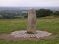 |
Lia Fáil |
Meath |
53°34′39″N 6°36′43″W / 53.57750°N 6.61194°W / 53.57750; -6.61194 (Lia Fáil) |
standing stone |
-
|
 |
Lisnadarragh Wedge Tomb |
Monaghan |
54°0′48″N 6°53′44″W / 54.01333°N 6.89556°W / 54.01333; -6.89556 (Lisnadarragh) |
wedge tomb |
-
|
 |
Listoghil
(part of Carrowmore) |
Sligo |
- |
- |
5380–5640 years
|
 |
Loughcrew Cairns |
Meath |
53°46′10″N 7°6′11″W / 53.76944°N 7.10306°W / 53.76944; -7.10306 (Loughcrew Cairns) |
cairns |
5300–5500 years
|
| - |
Magh Slécht |
Cavan |
- |
various |
-
|
 |
Meehambee Dolmen |
Roscommon |
- |
portal tomb |
5500 years
|
| - |
Moylehid |
Fermanagh |
- |
passage tomb, cairn |
-
|
 |
Newgrange or Sí an Bhrú
(part of Brú na Bóinne) |
Meath |
53°41′39.73″N 6°28′30.11″W / 53.6943694°N 6.4750306°W / 53.6943694; -6.4750306 (Newgrange) |
passage tomb |
5000 years
|
 |
Poulnabrone dolmen |
Clare |
53°2′55.83″N 9°8′23.83″W / 53.0488417°N 9.1399528°W / 53.0488417; -9.1399528 (Poulnabrone dolmen) |
portal tomb |
-
|
 |
Slidderyford Dolmen |
Down |
- |
portal tomb |
-
|
| - |
Tallowroe |
Galway |
- |
standing stone |
-
|
 |
Templebryan Stone Circle |
Cork |
51°38′35″N 8°53′00″W / 51.64316°N 8.88335°W / 51.64316; -8.88335 (Templebryan Stone Circle) |
stone circle |
-
|
 |
Tibradden |
Dublin |
53°14′20.15″N 6°16′52.74″W / 53.2389306°N 6.2813167°W / 53.2389306; -6.2813167 (Tibradden) |
passage tomb |
-
|
 |
Townleyhall
(part of Brú na Bóinne) |
Louth |
- |
passage tomb |
-
|
 |
Turoe stone |
Galway |
53°15′N 8°33′W / 53.250°N 8.550°W / 53.250; -8.550 (Turoe stone) |
standing stone |
-
|
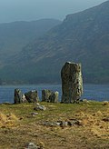 |
Uragh Stone Circle |
Kerry |
51°48′42.23″N 9°41′37.74″W / 51.8117306°N 9.6938167°W / 51.8117306; -9.6938167 (Uragh Stone Circle) |
stone circle |
-
|

,_October_2009.JPG)
.jpg)


Jul2007.jpg)
Jun2008.jpg)
,_September_2009.JPG)


.jpg)


,_December_2009.JPG)


.JPG)


