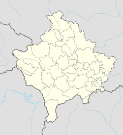
Lipjan (Albanian definite form: Lipjani) or Lipljan (Serbian Cyrillic: Липљан) is a town and municipality located in the Pristina District of Kosovo. According to the 2011 census, the town of Lipjan has 6,870 inhabitants, while the municipality has 57,605 inhabitants.
Lipjan | |
|---|---|
Town and municipality | |
| Coordinates: 42°32′N 21°06′E / 42.533°N 21.100°E | |
| Country | Kosovo |
| District | District of Pristina |
| Named for | Ulpiana[1][2][3][4][5] |
| Government | |
| • Mayor | Imri Ahmeti (LDK) |
| Area | |
• Municipality | 338 km2 (131 sq mi) |
| • Rank | 15th in Kosovo |
| Population (2024)[6] | |
• Municipality | 55,044 |
| • Ethnicity | |
| Time zone | UTC+1 (CET) |
| • Summer (DST) | UTC+2 (CEST) |
| Postal code | 14000 |
| Area code | +383 38 |
| Vehicle registration | 01 |
| Website | kk |
Name
editThe town's name derives from Ulpiana,[1][2] the Dardanian and Roman era settlement that preceded Lipjan, possibly due to either a Ul- to Li- shift seen elsewhere in Roman toponyms.[3] Selami Pulaha states that the shift from Ulpiana to Lipjan is in accordance with early Albanian phonetic rules, and must therefore have been inhabited by Albanians to reach its current form.[4] Lipjan (Lypenion) is considered to have preceded the Slavic migrations in the region.[5]
The Roman city of Ulpiana was located near Lipjan and it was named in honor of the Roman Emperor Marcus Ulpius Nerva Traianus. In the early Middle Ages it was part of the Bulgarian Empire and a diocese of the Bulgarian Patriarchate. The neo-Latin form Lypenion for the city occurs for the first time in a Byzantine text from 1018 AD that confirmed the town as an episcopal seat of the Bulgarian Archbishopric of Ohrid following the Byzantine conquest of Bulgaria in the same year.[7]
Geography
editLipjan is located in the central part of the Republic of Kosovo and at the crossroads of the most important roads in the region. The town is located south of Pristina at a distance of around 17 km (11 mi). The Municipality of Lipjan contains 422 km2 (163 sq mi) of land, and it consists of 70 villages. It borders the municipalities of Drenas, Kosovo Polje and Pristina to the north, Malisheva to the west, Novo Brdo and Gjilan to the east and Ferizaj, Suva Reka and Shtime to the south.[8]
History
editEarly Period
editThe ancient predecessor of Lipjan, Ulpiana, was an important city in the Illyrian and Dardanian spheres. By the 2nd century CE, it was the economic, political and culture centre of the province of Dardania.[9] It was situated on a road between ancient Naissus and Lissus, called Via de Zenta. It suffered from barbarian raids, especially the incursion of 517CE, and from a great earthquake that damaged much of Dardania. By the time Justinian I began his restoration of the Byzantine Empire, Ulpiana was in a ruinous condition - after repairing the town, Justinian labelled it Justiniana Secunda. Ulpiana also played an important ecclesiastical role, having had a local bishop present at the Council of Serdica in 347CE and at the Ecumenic Synod of 553CE. Florus and Laurus were said to have settled in Ulpiana. The old Byzantine church in Lipjan serves as a reminder of the ecclesiastical importance the area once held - it continued to hold a bishopric seat in the Bulgarian empire and once again in the Byzantine empire once the region was recaptured.[10]
Middle Ages
editLipjan is the birthplace of the Albanian noble, Lekë Dukagjini,[11] who was born here in 1410. He was a close friend of the Albanian military commander and ruler, Gjergj Kastrioti Skanderbeg, and a participant in the Albanian League of Lezhë. He was a member of the Dukagjini family, whose principality extended from Northern Albania to modern-day Kosovo.[12][13]
Kosovo War
editLipjan was the site of war crimes during the Kosovo War. Ethnic Albanians were forced out of the area on April 20 by Serb forces, and Albanian residences were looted and burned by said forces. Serbian paramilitary forces were alleged to have shot more than 50 civilians in 3 surrounding villages.[14]
Demographics
edit| Year | Pop. | ±% p.a. |
|---|---|---|
| 1948 | 29,700 | — |
| 1953 | 33,132 | +2.21% |
| 1961 | 38,573 | +1.92% |
| 1971 | 47,526 | +2.11% |
| 1981 | 57,705 | +1.96% |
| 1991 | 69,451 | +1.87% |
| 2011 | 57,605 | −0.93% |
| 2024 | 55,044 | −0.35% |
The municipality of Lipjan has 55,044 inhabitants according to the 2024 census,[6] compared to 57,605 in 2011.[15] In the same year, 6,870 lived in the town, while the general age of the population was also young; 40% were aged 0-14 years, 45% 15-65 and 15% over 65. The average family size was also five people.[16]
Ethnic groups
editThe ethnic composition of the municipality of Lipjan:
| Ethnic group | 2011 census[15] | in % | 2024 census[6] | in % |
|---|---|---|---|---|
| Albanians | 54,467 | 94.55 | 51,861 | 94.22 |
| Ashkali | 1,812 | 3.15 | 1,891 | 3.44 |
| Serbs | 513 | 0.89 | 569 | 1.03 |
| Romani | 342 | 0.59 | 318 | 0.58 |
| Others | 471 | 0.82 | 405 | 0.73+ |
| Total | 57,605 | 100.00 | 55,044 | 100.00 |
Religions
editThe religious composition of the municipality of Lipjan:
| Religion | 2011 census[17] | in % | 2024 census[18] | in % |
|---|---|---|---|---|
| Islam | 56,384 | 97.88 | 53,635 | 97.44 |
| Eastern Orthodoxy | 520 | 0.90 | 533 | 0.96+ |
| Roman Catholicism | 572 | 0.99 | 455 | 0.82+ |
| Others | 7 | 0.01 | 75 | 0.13+ |
| No religion | 6 | 0.01 | 50 | 0.08+ |
| Prefer not to answer | 68 | 0.12 | 296 | 0.57+ |
| Unavailable | 48 | 0.09- | - | - |
| Total | 57,605 | 100.00 | 55,044 | 100.00 |
Municipality
edit- Akllap/Oklap
- Babush i Muhaxherëve/Muhadžer Babuš
- Baicë/Banjica
- Banullë/Bandulić
- Breg i Zi/Crni Breg
- Brus
- Bujan/Bujance
- Bukovicë/Bukovica
- Divlakë/Divljaka
- Dobrajë e Madhe/Velika Dobranja
- Dobrajë e Vogël/Mala Dobranja
- Gadime e Epërme/Gornje Gadimlje
- Gadime e Ulët/Donje Gadimlje
- Gllanicë/Glanica
- Gllavicë/Glavica
- Gllogoc/Glogovce
- Grackë e Vjetër/Staro Gracko
- Grackë e Vogël/Malo Gracko
- Gumnasellë/Guvno Selo
- Hallaç i Madh/Veliki Alaš
- Hallaç i Vogël/Mali Alaš
- Hanroc/Androvac
- Janjevo/Janjevë
- Kleçkë/Klečka
- Kojskë/Konjsko
- Konjuh
- Kraishtë/Krajište
- Krojmir/Krajmirovce
- Leletiq/Laletić
- Lipovica
- Livađe/Livagjë
- Llugaxhi/Lugadžija
- Llugë/Lug
- Magura
- Marec/Marevce
- Medvec/Medvece
- Mirenë/Mirena
- Okosnicë/Okosnica
- Plitkoviq/Plitković
- Poturoc/Poturovce
- Qellapek/Čelopek
- Qyqylagë/Čučuljaga
- Resinoc/Rusinovce
- Ribar i Madh/Veliko Ribare
- Ribar i Vogël/Malo Ribare
- Ruboc/Rabovce
- Rufc i Ri/Novo Rujce
- Rufc i Vjetër/Staro Rujce
- Shalë/Sedlare
- Shisharkë/Šišarka
- Sllovi/Slovinje
- Smallushë/Smoluša
- Teqë/Teća
- Topličane
- Torina/Torinë
- Trbovce/Tërbuc
- Varigoc/Varigovce
- Vërshec/Vrševce
- Vogaçicë/Vogačica
- Vrelo
- Vrellë e Goleshit/Goleško Vrelo
- Zlokućane
See also
editReferences
edit- ^ a b Illyés, Elemér (1988). Ethnic Continuity in the Carpatho-Danubian Area. East European Monographs. p. 172. ISBN 9780880331463.
- ^ a b Du Nay, André (1977). The Early History of the Rumanian Language. Jupiter Press. p. 17. ISBN 9780933104037.
- ^ a b Lafe, Emil (1976). "Toponymes latino-romans sur le territoire de l'albanais". Iliria. Page 116
- ^ a b Pulaha, Selami (1984). Popullsia shqiptare e Kosovës gjatë shek: studime dhe dokumente. XV-XVI. 8 Nëntori. p. 11.
- ^ a b Origins: Serbs, Albanians and Vlachs Chapter 2 in Noel Malcolm's Kosovo, a short history (Macmillan, London, 1998, p. 22-40) - "The scholar who first developed this argument also noted that, in the area dividing the early Serbs from the Bulgarians, many Latin place-names survived long enough to be adapted eventually into Slav ones, from Naissus (Nish), down through the Kosovo town of Lypenion (Lipljan) to Scupi (Skopje)."
- ^ a b c "Regjistrimi i Popullsisë, Ekonomive Familjare dhe Banesave 2024 - Të Dhënat E Para Finale" [Population, Family Economy and Housing Census 2024 - First Final Data] (PDF). Agjencia e Statistikave të Kosovës (in Albanian). 19 December 2024. p. 66. Retrieved 24 December 2024.
{{cite web}}: CS1 maint: url-status (link) - ^ Collective (1965). Greek Sources about Bulgarian History (GIBI), volume VI (in Bulgarian and Greek). Sofia: Bulgarian Academy of Sciences Press. p. 44.
- ^ Elsie, Robert (15 Nov 2010). Historical Dictionary of Kosovo. Scarecrow Press. p. 178. ISBN 9780810874831.
- ^ Warrander, Gail; Knaus, Verena (2010). Kosovo: The Bradt Travel Guide. Bradt Travel Guides. p. 139. ISBN 9781841623313.
- ^ Evans, John (1885). "Antiquarian Researches in Illyricum". Archaeologia, or, Miscellaneous Tracts, Relating to Antiquity. 49 (1): 62–64.
- ^ Nogueira, Adeilson (31 Mar 2018). Moedas De Kosovo. Clube de Autores. p. 16.
- ^ Sellers, Mortimer; Tomaszewski, Tadeusz (23 July 2010). The Rule of Law in Comparative Perspective. ISBN 9789048137497.
- ^ Warrander, Gail; Knaus, Verena (2007). Kosovo. ISBN 9781841621999.
- ^ Erasing History: Ethnic Cleansing in Kosovo. Department of State. 1999. p. 18. ISBN 9780160500657.
- ^ a b "Regjistrimi i Popullsisë, Ekonomive Familjare dhe Banesave në Kosovë 2011 - Rezultatet Përfundimtare - Të Dhënat Kryesore" [Census of Population, Family Economies and Housing in Kosovo 2011 - Final Results - Main Data] (PDF). Agjencia e Statistikave të Kosovës (in Albanian). 2013. p. 143. Retrieved 24 December 2024.
{{cite web}}: CS1 maint: url-status (link) - ^ "Plani Zhvillimor Komunal i Lipjanit 2013-2023+" [Municipal Development Plan of Lipjan 2013-2023+] (PDF). Komunat e Kosovës – Republika e Kosovës (in Albanian). July 2013. p. 79.
{{cite web}}: CS1 maint: url-status (link) - ^ "Regjistrimi i Popullsisë, Ekonomive Familjare dhe Banesave në Kosovë 2011 - Rezultatet Përfundimtare - Të Dhënat Kryesore" [Census of Population, Family Economies and Housing in Kosovo 2011 - Final Results - Main Data] (PDF). Agjencia e Statistikave të Kosovës (in Albanian). 2013. p. 146. Retrieved 24 December 2024.
{{cite web}}: CS1 maint: url-status (link) - ^ "Regjistrimi i Popullsisë, Ekonomive Familjare dhe Banesave 2024 - Të Dhënat E Para Finale" [Population, Family Economy and Housing Census 2024 - First Final Data] (PDF). Agjencia e Statistikave të Kosovës (in Albanian). 19 December 2024. p. 69. Retrieved 24 December 2024.
{{cite web}}: CS1 maint: url-status (link)


